Spring is coming!

Here we are on the Riding and Hiking Trail on our way back from Devil's Gulch.
I love being in the midst of winter, but seeing the signs of spring coming. In just the past couple of weeks we're beginning to see ducks in the creek, some swelling buds on trees and today, for the first time this season, I even saw flowers blooming along the trail. I guess it's the additional hours of sunlight since winter solstice that's triggering the growth - I don't think it's the temperature since it was 35 degrees this morning and doesn't get above the low 50s very often here under the Redwood canopy. We may have seen our last salmon for the season, though if we get some good rain again it might trigger more coming up the creek to spawn.

Here is a group of salmon we saw not too far from our campsite on January 11.

Here is one of those Coho Salmon on January 11.
The last salmon I saw in the park was a week ago on January 17.
That may be the last one we'll see before we return in December.

A duck in the creek

Here is a Bracken fern with fresh growth.
This one was up on the Barnabe Trail where it gets lots more sun than under the Redwoods.

Redwood Sorrel blossoms that caught my attention this morning.

Here is a blossom opened up this afternoon.

A Forget Me Not blooming along the trail this morning.
I've seen these in other places in the past week, but this is the first one in the Redwoods.

A Hounds Tongue plant I saw along the trail this morning - it will be awhile before it blooms.

Another sign of the coming spring is that the trail crew was out this past weekend.
Here is a tree they cut up.

And here it is before it was cut up.
About a month ago one of the rangers, who knows how much I hike the trails, asked me if I would be willing to help on a trail sign project. I of course said yes since it "requires" me to hike all of the trails! The project involves hiking all the trails, verifying mileage, taking pictures of all the trail signs and making out orders for replacements and new signs. I knew there were lots of signs in the park, but until I started doing this I didn't realize just how many signs there are for the little over 20 miles of trails in the park. So far I have hiked all the trails, taken pictures of existing signs and locations for potential new ones. I have also gained a real appreciation for the complexity of making sure signs are accurate and placed correctly. I still have many orders to fill out and more mileages to double check, but I'm loving this assignment, including the challenges involved. Most of the trail hiking I've done between morning and noon camp checks.


A view toward Tomales Bay from the Barnabe Trail on a morning hike to check signs and mileage.


Some deer in the woods on the way into check out Devil's Gulch area for signs and mileage.

This is on the Devil's Gulch Fire Road.
A good portion of the trail has slid down toward the Devil's Gulch Creek.

Looking at Mount Tamalpais from Barmabe Peak.

Looking at Mount Diablo from Barnabe Peak.


 And here is a piece of what I think is Chert that I picked up in my sanctuary spot at Samuel P Taylor.
 A Flux tower at Pepperwood with instruments atop to measure evaporation and other things.


 Zoomed in on the Farallons
 Some cliffs near Chimney Rock
 A "tunnel" rock below
 There were lots of new baby seals - these are out near Chimney Rock
 And here are lots of Elephant seals at the viewing area near the beginning of the trail
 They sort of look like giant slugs.
 The volunteer docent said this one had been in the parking lot when he arrived for his shift. He managed to herd it back to the beach and this is where it stayed, exhausted after its adventure.
 Another view of Elephant Seals up close.

 The entrance gate
 I've never seen this one before - iNaturalist tells me it's probably Warrior's Plume.

 Hounds Tongue in bloom

 The pretty creek that flows below the falls.
 Us with the falls behind


Hiking the whole Barnabe Trail (a six mile loop) took more than the time between morning and noon camp checks so I did this one on one of our days off.
The repair of the slide on Sir Francis Drake Blvd. was almost complete in this picture.
Notice in the picture that they are repairing the part of the trail that had also slid out. We were very impressed at how well Marin County saw to the repair of this slide - piling in tons and tons of rock, then covering it with dirt, planting native trees and berries, and eventually covering it with erosion proof cloth. The ironic thing about the trail repair is that this trail, North Creek Trail, is being abandoned by the State Park because the end of it near Devil's Gulch washed away years ago. Rob and I enjoy this trail as it is the shortest way to hike from the campground to Devil's Gulch, which we have done one time since this repair was made, even though there are "Trail Closed" signs that we put up warning folks not to hike this trail.
In my last post I mentioned that I have begun U.C.'s California Naturalist Course being held at Pepperwood Nature Preserve in the Mayacamas Mountains near Santa Rosa. The course is 50 hours, spread over 10 Saturdays at the beautiful Pepperwood property. I am learning a lot from the outstanding instructors, which include research scientists. There is so much material being covered and I can't possibly recall it all, but I'll try to share one "take away" from each week. Week one I learned that Madrone Trees are sometimes called "Refrigerator Trees" because of the cold feel of their trunks compared to other trees. This is because the cambium layer that transports water up the trunks has a very thin layer of bark covering it compared to other trees. Rob and I tested it today on a hike in Fairfax, and it's really true - the Madrone trees feel much colder than other nearby trees! The focus of the second week was on Geology and I was actually quite thrilled to learn that geology, including the identification of rocks, is much more complicated than the sixth grade science curriculum I taught many years ago would lead one to believe. I really appreciated it when our instructor held up a rock and said, "I'm not positive if this is metamorphic or sedimentary - sometimes it's really hard for scientists to tell!" The focus of the third week was hydrology and we got to observe the newly installed instruments being used to measure water coming in and out of the preserve in two different areas - one thinned of vegetation including the use of prescribed burns and one area left untouched. The hydrologist's hypothesis is that the thinned area will hold ground moisture longer than the other since there are less trees to draw the water away.
A view looking south west from the Pepperwood Preserve
A creek we sat by on the geology day of class.
Can you see the pinkish rock in the center?
Here it is up close - a beautiful example of red chert - a sedimentary rock - I think/hope.
I thought the green on the rock was moss, but actually it is algae.
There are also instruments deep in the ground to measure soil moisture and of course weather stations nearby to measure rainfall, and instruments in a nearby creek to measure runoff.
This array is a fog collector.
Last Tuesday, on our day, off we drove over to Point Reyes and hiked the Chimney Rock Trail for the first time. It was a beautiful day, with beautiful scenery, lots of birds, lots of baby Elephant Seals and even some wildflowers.
A raptor flying over Drake's Bay - I can't identify it.
Ravens on the near rock and Cormorants on the far rock.
A seagull in flight
The Farallon Islands
On the way back from the Chimney Rock hike we stopped at the Drake's Bay Visitor Center to eat our lunch on the deck there and we got to see some of the "bachelor" seals up close.
The beach at Drake's Bay
Last week while hiking in Devil's Gulch we met a woman who lives in nearby Fairfax and she asked us if we'd ever been to the Cascade Falls that are near Fairfax. No, we hadn't, but today we headed to the Elliott Nature Preserve about 10 miles from Camp Taylor, and after a challenge finding parking on the narrow street that dead ends at the Preserve we headed out in the beautiful morning for a short hike to the falls. The hike would be a bit of a challenge if it had rained recently as there are places you have to ford the creek, but since it's been a while since any rain we had no problems today. There were more flowers blooming here and the falls were very pretty.
Some Milk Maids - we'll be seeing lots of these soon at Camp Taylor, but not yet.
A pretty little Shooting Star
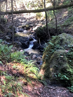
There were places with lots of ferns growing on the steep creek banks.
 Cascade Falls
There are many falls named Cascade, but this is the Fairfax edition.
Closing this post with more pictures of mushrooms - more keep popping up as others disappear.
These are Waxy Redcaps, I think.
Some more red ones.

And here are yellow ones

These mushrooms on a log are really pretty with a touch of green - lichen? moss? algae?

Some small mushrooms I had to step over on a trail.

These appeared this morning - quite pretty!

I'm calling this a "Shelf" mushroom.
We've seen a number of these, but this is the first one I saw high above me.

Straus sweetly grooming Elsie

The two not being so sweet.
Just before I took this picture they were swatting and hissing at each other.
It seems to be a part of their "exercise."
They are siblings and they relate to each other in many ways like human child siblings.


I so enjoy your blogs and admire how much you know about nature. What a wonderful adventure you are having. I'm glad for you.
ReplyDelete