A Pilgrimage in Sweden - Before, During and After - Part Two - During
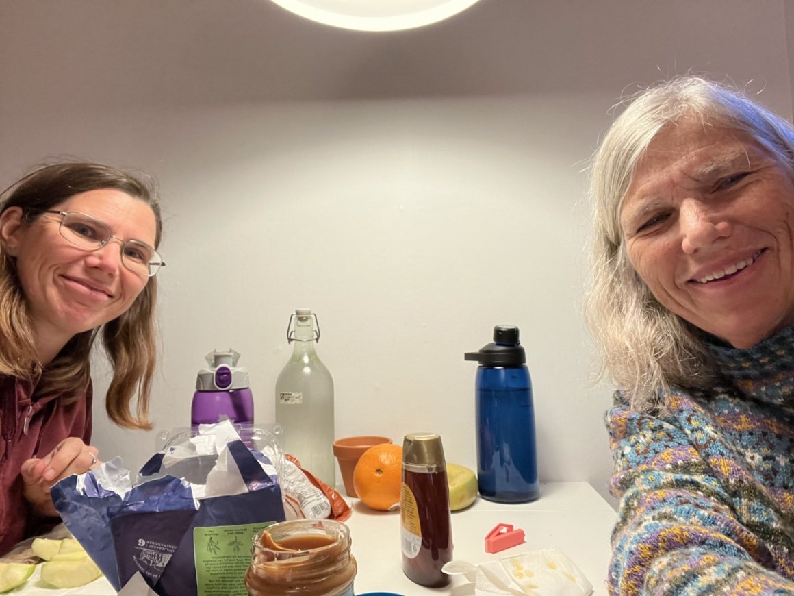
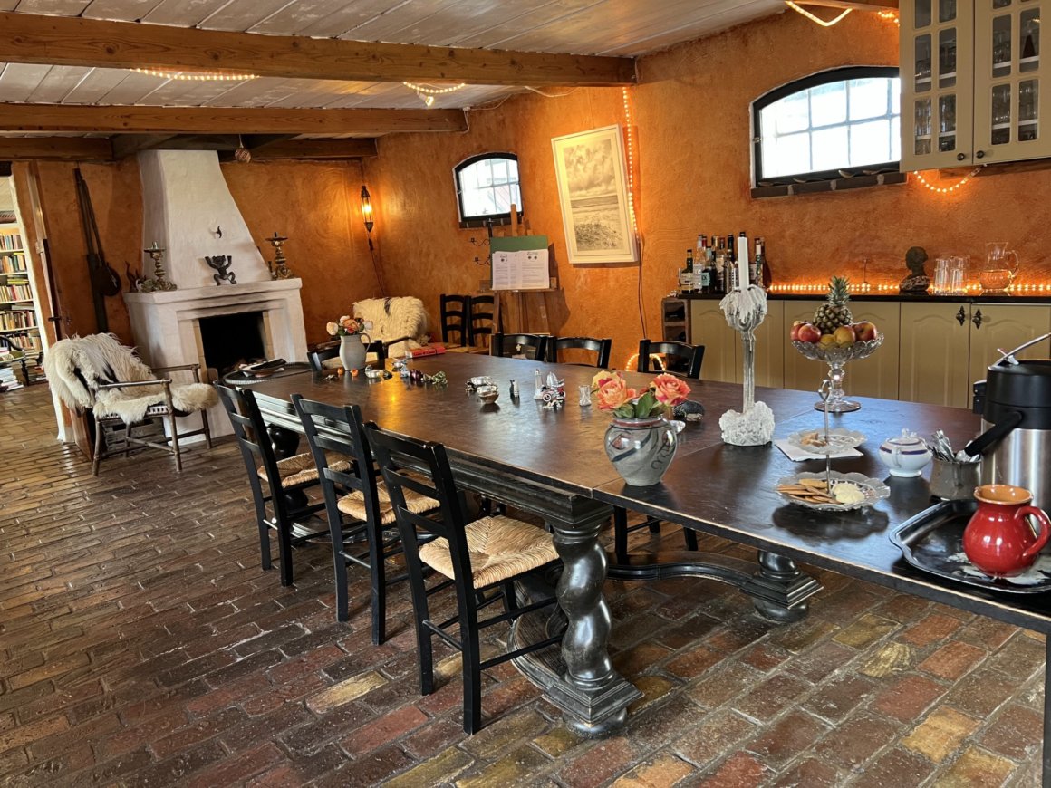
Sheila and me sharing our first meal in the Air B & B in Önnestad, Sweden.
The jar of peanut butter was replaced during our time in Sweden,
but the honey jar made it to Cyprus with us.
We had very nice accommodations in a bedroom behind the garage next to the house of a delightful young family with two small children. Our bathroom was in the main house, and this accommodation was in the true spirit of the original Air B & Bs with a family sharing its home with strangers. We were comfortable and safe, and truly enjoyed visiting with the family.
I am referring to our time in Sweden as "Pilgrimage," but what do I mean by that? I'm not entirely sure. I have always been intrigued by the concept of pilgrimage, of traveling to some destination on a long journey on foot. The current most popular pilgrimage I suppose is the Camino de Santiago de Compostela in Spain. I have read many accounts by those who have taken that journey on foot. Its most popular route today is 500 miles long, beginning in France, but actually there are many, many routes to Santiago, Spain beginning all over Europe - even in Sweden we learned as the trail we walked on was part of one of those routes. The only long distance hike/walk I have taken was the Tahoe Rim Trail in 2016, officially 165 miles, but because of some re-routings it is actually over 170 miles. I've thought about walking longer trails, but probably won't at this point in my life, but I have long been interested in long distance walking, always more for the sake of walking than with the idea of making a pilgrimage somewhere. I have read books about Pilgrimage, studied the various definitions, and it still seems to me a some what illusive term. This morning in my journal I wrote my own definition of pilgrimage: "An intentional journey one feels compelled to take, but not necessarily with a particular destination in mind. It may be goal oriented, but the journey itself and the unknown parts of the journey, that which will be discovered along the way is more important than what is expected ahead of time." Sheila and I both love walking, and more walking. We chose Sweden to walk because it was a place neither of us had much experience with and it is the birth place of some of our ancestors. We didn't go expecting to find anything in particular, but we did want to experience something of the place where my great grandparents came from as children.
On informational signs at a couple of the churches we visited was a description of our route being part of the Pilgrim Way connecting to Santiago de Compostela. These signs said, "A pilgrimage bears the stamp of the pilgrim's seven keywords: simplicity, slowness, silence, sharing, freedom, spirituality and light-heartedness." At first I wasn't sure our journey reflected all of these words very well, but then I realized how each one was manifested in the 10 days we spent in Sweden.
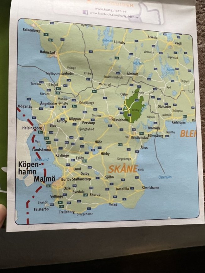
If you zoom in on this map you can see Copenhagen (Köpenhamm), the bridge we crossed to Malmö, Ystad on the Baltic Sea at the bottom of the map where our Inn to Inn hike would begin, and the location of Broby in the green highlighted area.
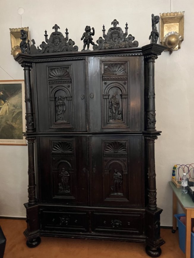
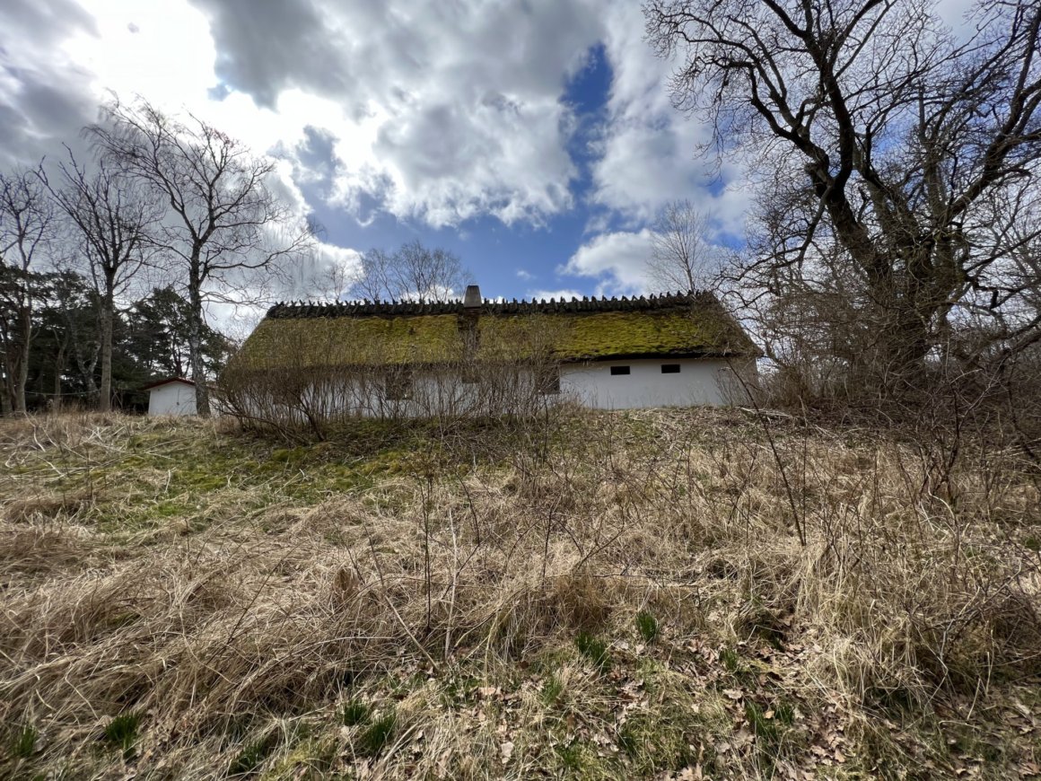
This cabinet was near the front of the Lutheran Church in Broby Switzerland.
It was one of the few things salvaged from a fire that destroyed much of the interior of the church.
This cabinet was repurposed from part of the old altar, an altar my family may very well have worshipped in front of.

The friendly priest showing us this historic vestment from 1827.
The priest told us that my great grandmother would most definitely have seen this if she were ever at services in Broby because the priest wore it every Sunday, and in fact this priest who has served this parish for over 20 years wore it every Sunday until just a few years ago when it was determined the fabric was deteriorating.

We had a lovely salad buffet.

The priest encouraged us to go to Gryt, the other possible location of my Great Grandmother's birth.
It is a very small village, but the church is well preserved, much more beautiful he said than the one in Broby. It was 7 kilometers (4.34 miles away) from the closest bus route with no public transportation so we walked along the country roads to get there - in the rain. We made contact with someone from the Gryt church to let us in later in the afternoon.


The Gryt church

In our rain gear with the church behind.
It rained pretty much all day on this day, and the best part of that was that we found out we had gear that would keep us dry and warm no matter what the weather before us. The forecast for the whole week ahead was for rain or snow every day, but fortunately this day was the wettest, and we only had a little "popcorn" snow on our first day hiking Inn to Inn.


We learned that this church only holds one service a year now and that is at New Years.
It is also used for weddings and funerals.

The organ in the back of the Gryt church.

The baptismal font where my great grandmother was very possibly baptized.

This is the old baptismal font that was found being used for a pig feeding trough not too many years ago. It had been missing for a very long time, since before my great grandmother's birth.
From Gryt we had to walk back to our bus route. We walked a little further on the road and found a forest path back to the main road and the bus that would take us back to the train to return to Önnestad where we would spend one more night before heading by train and bus to Ystad where the Inn to Inn hike I had booked would begin. On the morning of Friday, April 8, we walked to the train station where we would take the train one stop to Kristianstad where we would change to a bus that would take us to Ystad.

We missed the first bus connection because we couldn't find the correct stop in time, so we had an hour to walk around Kristianstad.

A church in Kristianstad near the bus and train station.


It looked like a coffin to me and I wondered if it held relics, but on closer inspection we realized it was for collecting offerings. It seems they didn't trust the old lock since there are two modern locks on it. I wonder how old this was, and whether it was always for collecting offerings.
I found the Inn to Inn hike by doing a Google search for Inn to Inn hikes in Sweden. I found what looked good and had booked our planned September hike through Traventuria Ltd., a company based in Bulgaria. I was very impressed then with how well planned the trip looked and how well they treated me when I had to cancel that trip, so I of course booked the one we finally got to do. The package included accommodations for 7 nights with breakfast at each location and dinner on the final evening, a taxi from the final lodging to a bus stop, detailed walking instructions for six days of hiking, maps, and the transport of our luggage between lodgings. All we had to do was carry our day packs, and follow the well described and signed route on a little over 100 kilometers of the 1000 kilometer Skåneleden Trail. In Sweden the company used a small company called Vandra to manage the tour. We have high praise for both Traventuria and Vandra - they delivered on every promise they made. We did have some confusion leaving the trail to find our accommodations in two of the locations, but even then we easily found our way.

 .
.On the street in Ystad on our way to our first hotel.
Sheila is wearing her day pack in front because her suitcase is on her back.

Hotell Sekelgården in Ystad.
We were delighted with our first impression on the outside - and on the inside.
All of our accommodations were outstanding with friendly, informative staff.
At this location, the proprietor said he had relatives in the U.S. so we were his friends and he would give us a special room - it was indeed nice with a separate sitting room.

It was snowing!
We arrived early enough in Ystad to get to explore the delightful old town area we were in. We went out to find a late lunch and to explore the area.

Some snow at the base of a tree
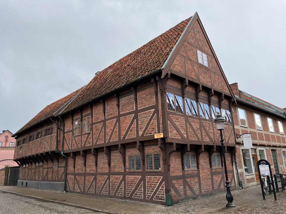
The oldest preserved half-timbered house in Scandinavia (1480)

We would learn that it was for Easter - a little over a week away.
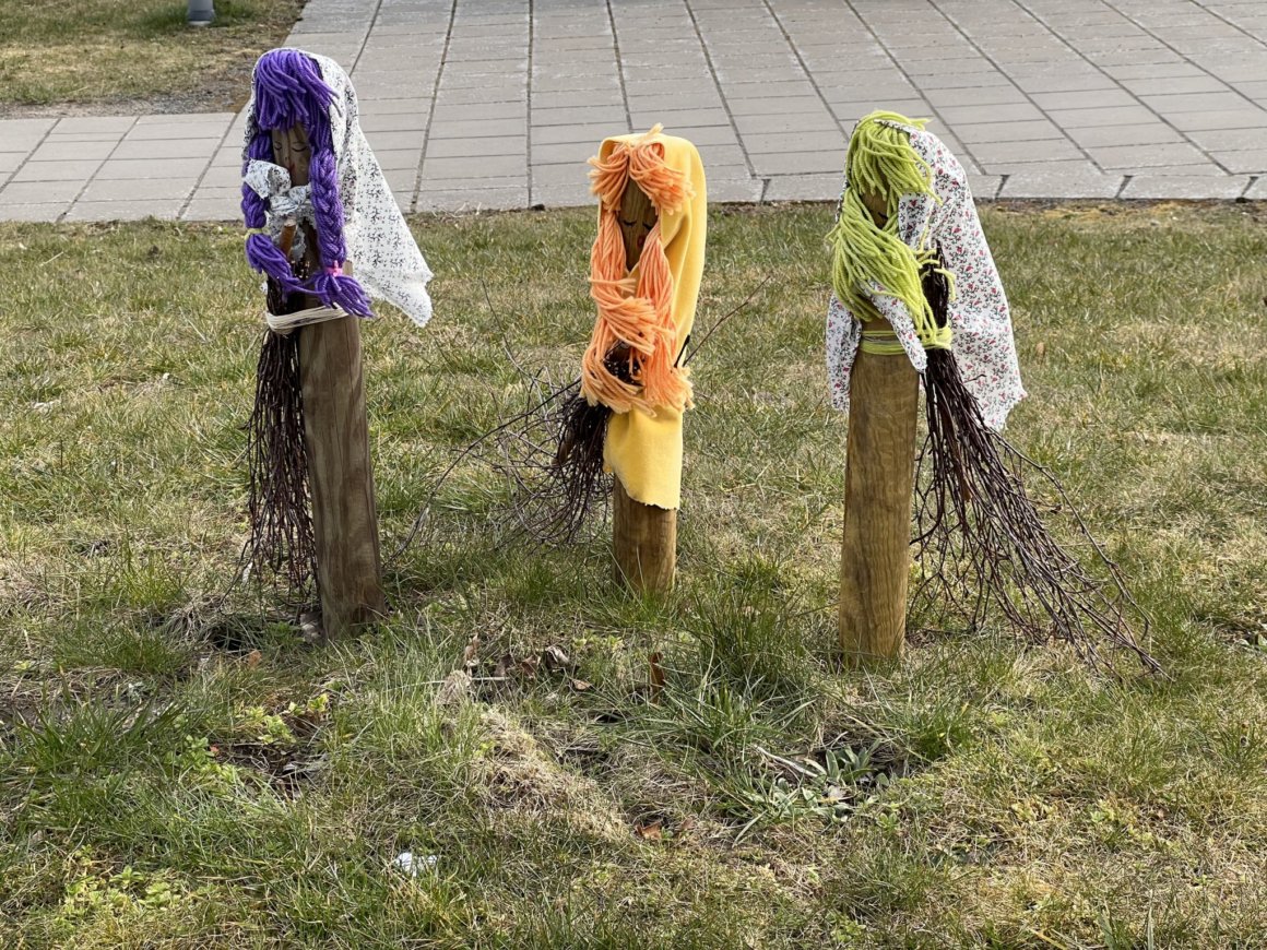
Some trees we would see had feathers instead of colored cloths like this one

This location was one of 13 in Sweden for this Cafe.
The young man who waited on us was very interested in the hike we were about to begin and in California, where I had come from. He had been to California once, but only to Los Angeles. He had a hard time believing that where I come from in California in the Sierra Nevada mountains that it snows. We met lots of people that thought California is only sunny.


There were lots of daffodils blooming everywhere.

A tree wrapped in knitted yarn


Duck houses on a pond at the Abbey

Ducks greeting us as we entered the Norra Promenaden.
They completely ignored a couple who entered the park just before us.
We figured they recognized the couple as ones who don't pass out duck treats and thought we might be different - we weren't.
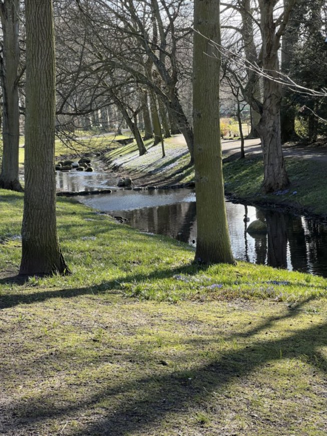
The pretty stream in the Promenaden
A dining room looking out to the stream

Dance sculpture not far from our hotel
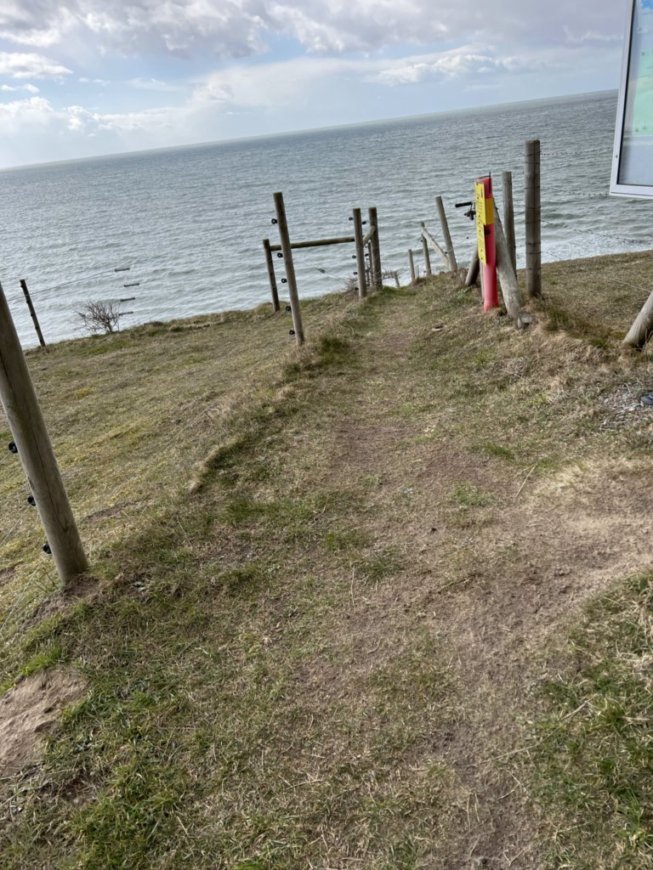
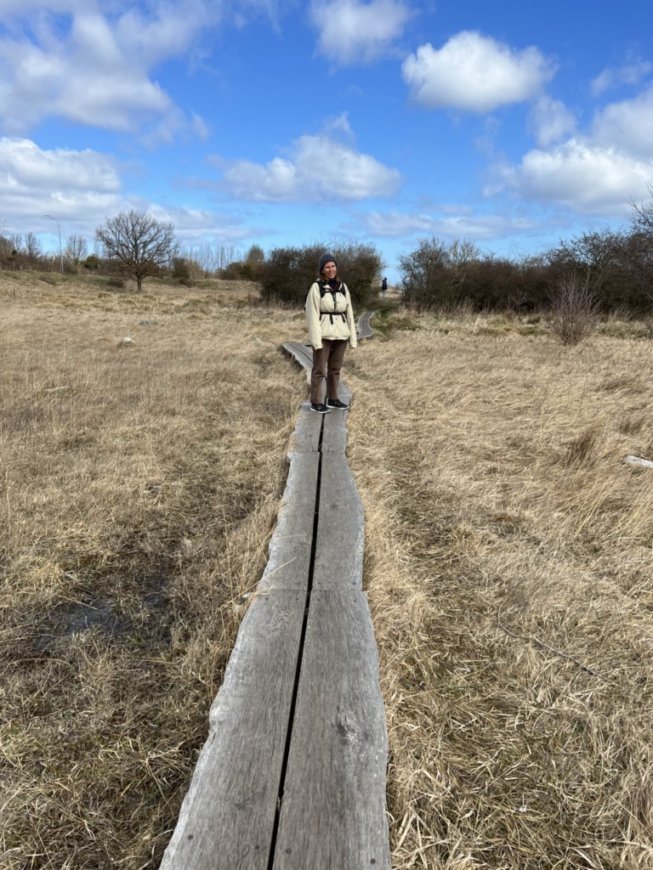
After a very nice buffet breakfast at the hotel we were ready to head out for our first day on the trail. Our guide book told us our route from Ystad to Kåseberga would cover 20.5 kilometers (12.71 miles) and that we would be walking along the Baltic Sea and in and out of Nature Reserves. we were ready to begin this part of our Pilgrimage!

The beginning near the train station.
Notice the orange signs above us. These well placed markers would not fail to keep us on course. Most places they were simply an orange square on a post along the trail. Where there was a path in front of us that might look like the way we should go, but wasn't, there was always an orange square with an X.

Beginning to walk along the sea

Little Beach Houses awaiting the summer season.

A big beach house in the woods behind the little houses.


Horse transportation motorhome style.

Heading into the woods for a bit.

There was no rain, though the forecast had predicted it.
Later we did get a bit of what Sheila and I call popcorn snow, but the Swedes call hail.

Here we followed a bike bath next to a highway.
Further ahead we would loose the bike path and have to walk on the side of the road for a bit before heading across a pasture and up on the the ridge above the sea.

On our way up between pastures.

Sheila crossing the first stile.
This was the first of 8 stiles on our first day - some more intimidating to me than others, but we would get used to them and appreciate the way they designed the top uprights for good support as we crossed.


Looking inland from the top of the pasture ridge.


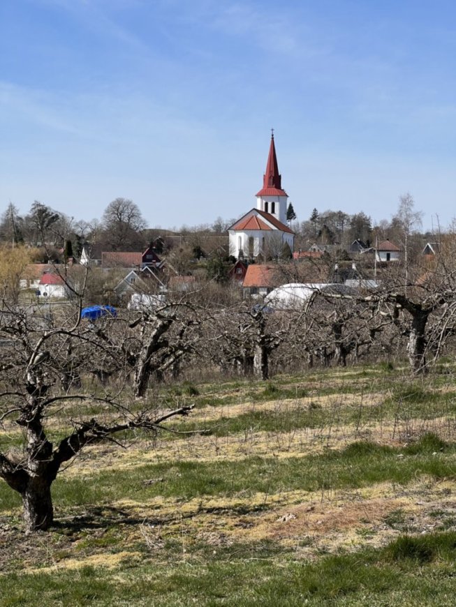
Interpretive material told us this was the "largest and best preserved ship setting in Sweden." It was 59 stone boulders arranged in the shape of a ship, 70 meters long, 19 meters wide, each boulder weighing around 5 tons, was erected between 500-1000 AD, and is one of the most frequented ancient monuments in Sweden.


Our trail went right through the monument which was a short distance from the end of our day's journey. Up until this point we had only seen two or three local walkers, but here there were many people visiting the stones.

The village of Kåseberga, the end of the first day's hike.
We would still need to walk about a mile to our lodging for the night.


The common area at our B & B.
When we arrived we were greeted by our warm and friendly host who showed us to our room where are suitcases were waiting for us. It always felt like magic to see them each time we arrived at our night's lodging. There was one other couple staying here the night we were and we enjoyed a conversation with them after dinner (here we had pre-ordered it and it came from a local caterer). The couple was from 600 kilometers north west in Sweden. They lived near a large lake where they kept a sailboat, and in the winter they engaged in the "sport" of ice bathing. They showed a picture of the hole cut in the deep ice over the hole and of her coming out of the hole after briefly bathing in the water beneath. BRRRRR!

Looking out our bedroom window.
Day 2's hike from Kåseberga to Skillinge was described as 21.5 kilometers, (13.33 miles) slightly longer than the first day. Each day we actually walked further than the written miles. We didn't detour a lot, but did do a few extra steps sightseeing, and the mileage did not include leaving the trail to get to our lodging locations. Some were right on the trail, but most were a kilometer or more off the main trail. Our host at the B & B told us of a shorter way to re-join the trail than the way we had come off it the night before, and it included much less walking along the highway. Our route this day would also follow the sea, but would also go inland through beautiful and interesting nature preserves, ending at a very eclectic old farm house B & B - our favorite accommodation of the trip.

There was a guard in front of a secure fence and we asked if it was a water tower.
His reply was that he couldn't tell us - clearly this was some sort of secret, possibly defence, structure overlooking the coast of the Baltic Sea.

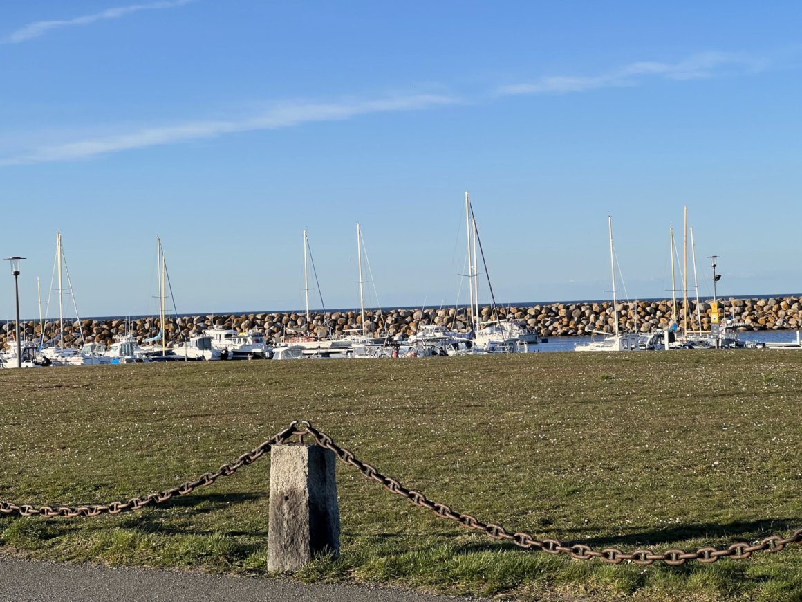
The harbor at Kåseberga where Day 1 hike ended and where our hike this day began.
The stones of Ales Stenar are visible on the ridge above the harbor.

Seeing rain, but not feeling it.


A long stairway down to the beach where we would walk.
Can you see Sheila at the bottom of the stairs?

Grape Hyacinths next to the stairs,
a familiar spring garden flower in Grass Valley, California where I grew up.
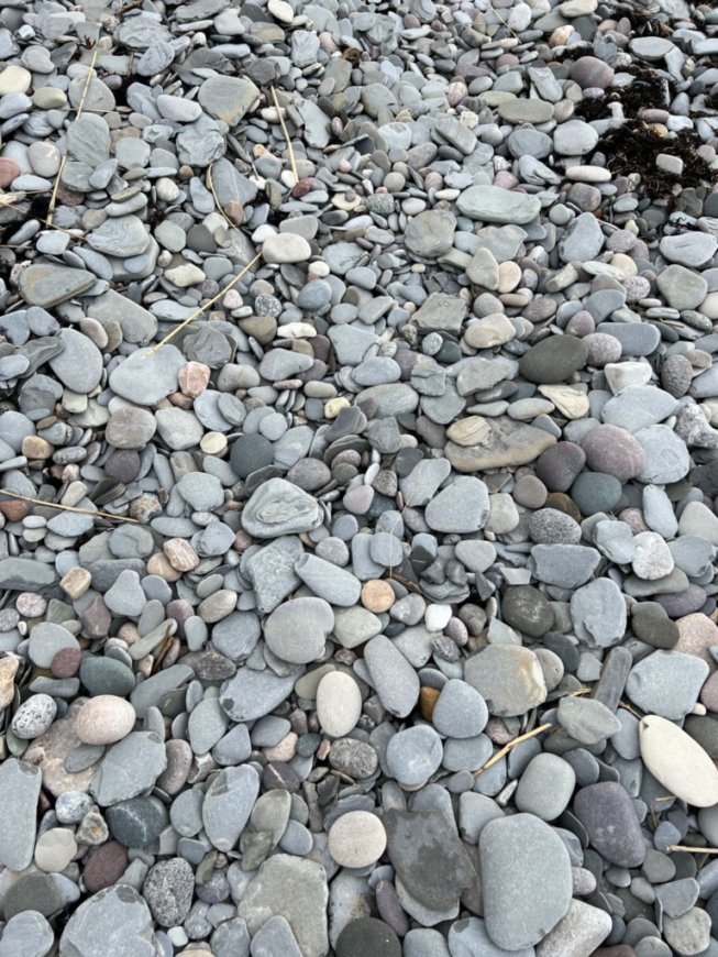
I thought that was because they were relatively flat, like shingles, but Sheila told me that shingles was a common British word for stones. They weren't too difficult to walk on.

Beauty over the sea.

Emptying sand before leaving the beach.

Wow! Coming out into a beautiful open space with the sea beyond.
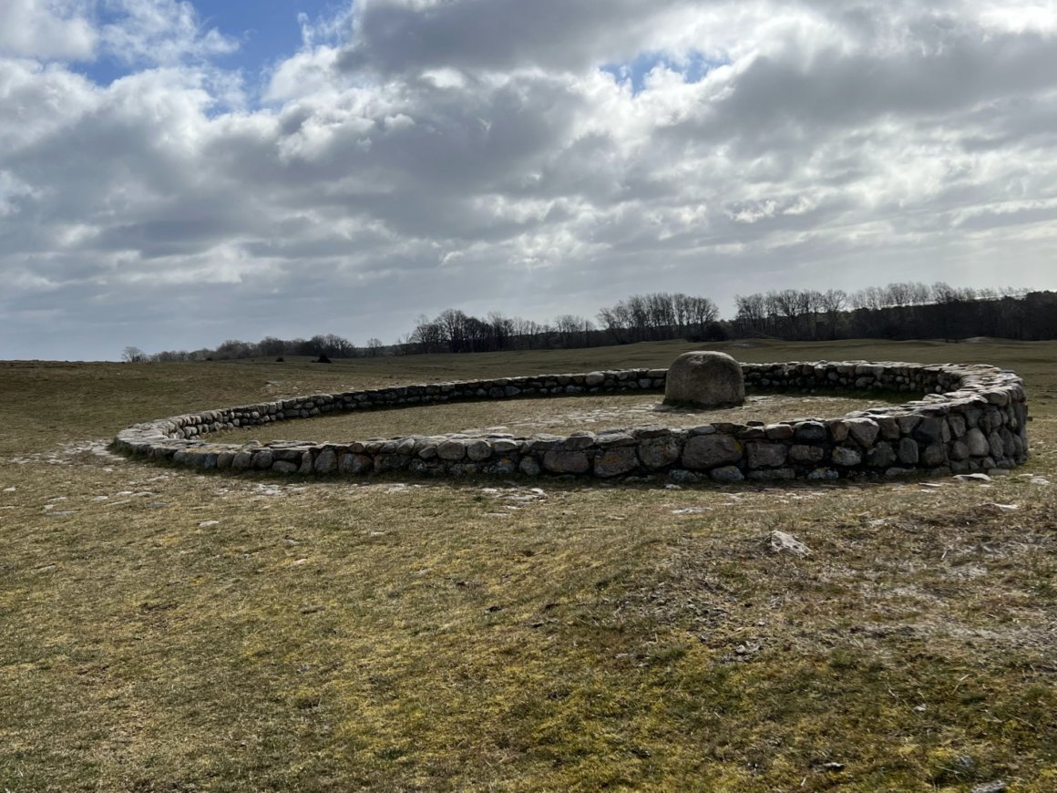
This meditation circle was in the beautiful open space.

Inside the meditation circle looking out.
We wondered what ancient civilization may have built this stone circle, but we found out from a sign nearby that it was created in memory of Dag Hammerskgöld following his death in 1961. Hammerskgöld, Secretary of the United Nations from 1953 to 1961, had purchased this land and the surrounding area in 1957 in order to conserve the open landscape.
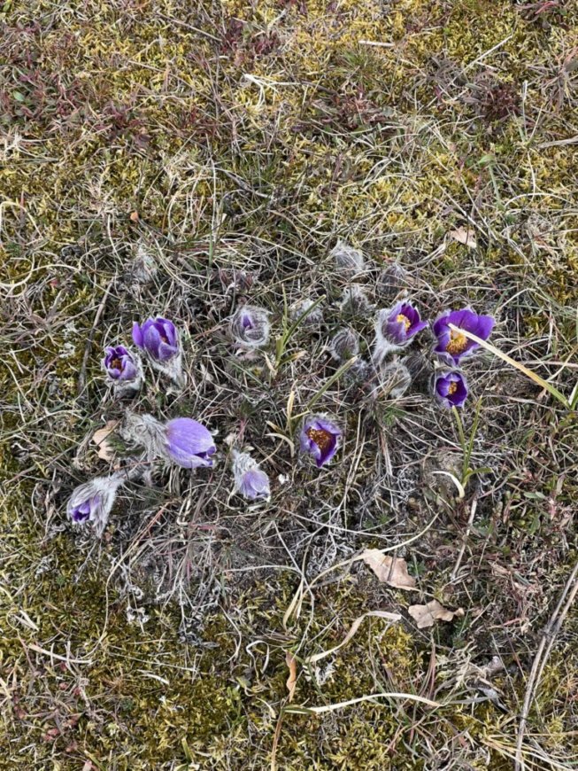
Pasque Flowers
We saw these in various stages of opening almost every day we hiked.
I learned from a friend that they are the state flower of South Dakota.

We saw many of these bushy tailed, reddish squirrels in the forests we walked through.
Except for the long, hairy ears they looked very much like the bushy tailed grey squirrels in California.

An old house in the nature reserve.


Boardwalk to the famous white beach of Sandhammaren.

A house along the beach.

Another traditional roof.
We would see many of these interspersed with modern roofs.
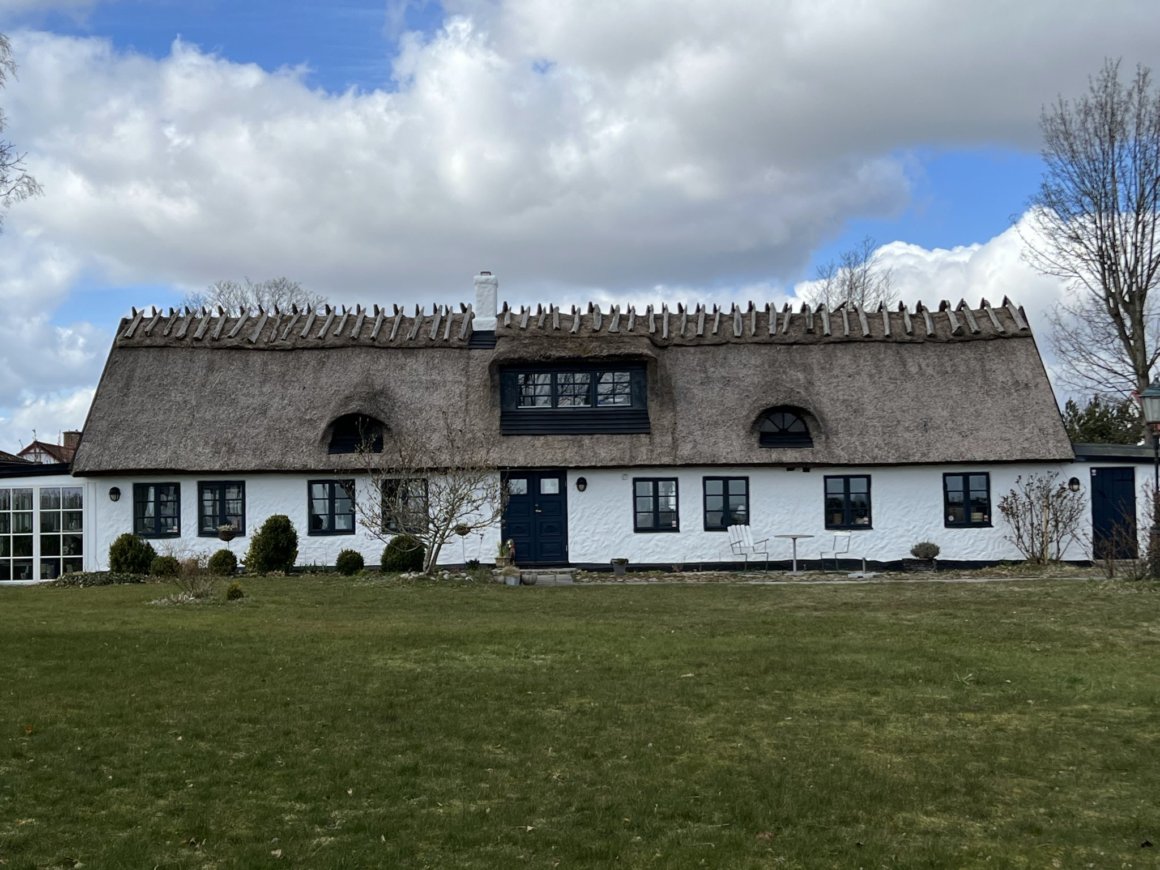
Some of these buildings were old and preserved in various states of repair, but many are apparently replicas as we would learn at our last night's lodging. The pieces of wood on the top are there to hold down the top layer of straw.

Ducks in the sea

Other birds in the sea.

Swans in the sea

Fisherman in the sea on a vehicle.
We would see other fishermen on the shore, and in the water with waders.
Fishing net drying poles - we saw many of these along our journey.

An American sized motor home - larger than what we've seen in other parts of Europe, but Sweden has more open space than other places we have been.


The courtyard of Sjöbacka gård, the converted farm house that would be our lodging in Skillinge.
This was our favorite accommodation of the trip.
It was quite eclectic, with lots of common areas and wonderful hosts.

The "sunset" dining room.


Sunset from the sunset room.

Sheila coming down from the loft area where there were many games and books (in Swedish of course) to choose from.

The loft room


Another sitting corner.
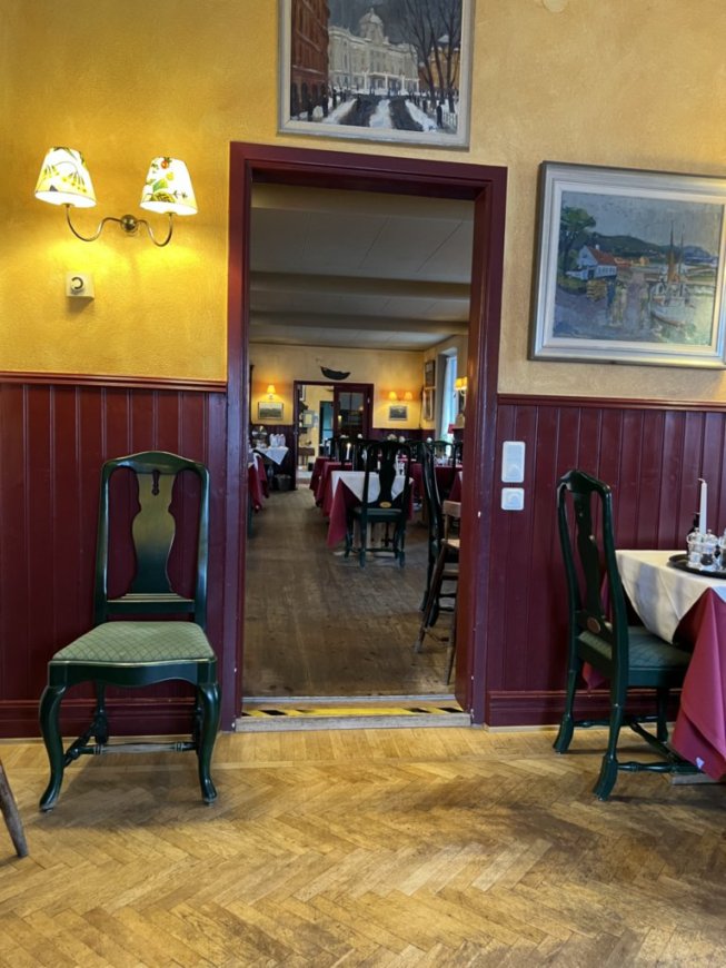
The main dining room.
Our bedroom was small, but very adequate and charming.
There were so many knick-knacks, what-nots and books in this house that if one wanted to get rid of something it seems you could easily leave it there and no one would pay much attention.
I don't want to live with so much "stuff," but it was fun to have a short stay amongst it.
Monday, April 11, Day 3 of our hike, would be a short day at 12.2 kilometers (7.6 miles), and would take us from Sillinge to Simrishamn, another village on the sea coast. Simrishamn was much larger than the previous two night's locations. Sheila figured that was planned so we would arrive early enough to spend money in the many shops and restaurants there. We did find a yarn shop where I bought a skein of yarn that came from the wool of local sheep, and we found a late lunch at a cafe. We did have dinner at our first two locations, pre-ordered because the tour company let us know there were no other options nearby. We found however that our breakfasts were very substantial and the peanut butter, crackers, and apple or two saved from breakfast, trail mix and trail bars would have been sufficient the rest of most days. We never would have wanted more than one restaurant meal a day. As it was, I ate way too much! Neither of us are foodies, preferring relatively plain, not fancy, fare.

Leaving the farmhouse, headed back to the sea.


We liked this stone stile.

A bench along the trail.


A pretty little stream.

A little free library with an attic.

A green finch.

I love skeleton trees.

Another one.
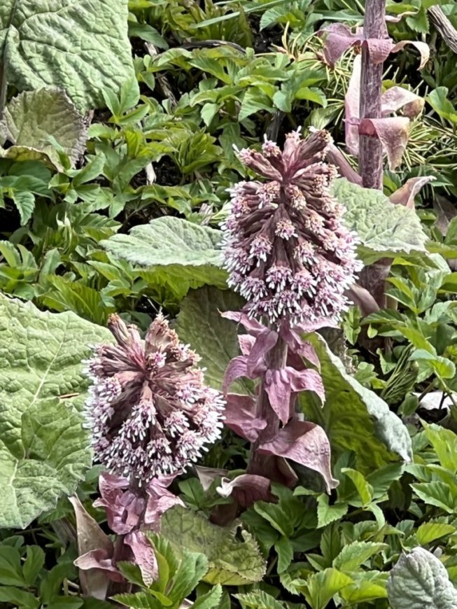
Butterburs - these reminded me of Snow Flowers in the Sierras.


A slight detour we took to view an area that contained petroglyphs.

The most distinct petroglyph we saw.


Eurasian Jacdaws - we saw lots of these birds that are closely related to crows.
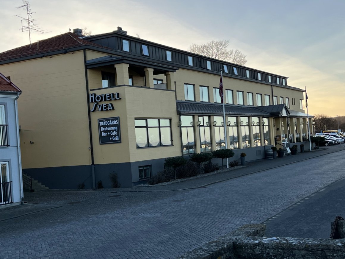
Hotel Svea - our night's lodging immediately adjacent to the trail.
This was a Best Western Hotel - perfectly adequate and nice, but not nearly so interesting as our other accommodations. After checking in we went off to explore, find lunch and the yarn shop.


A colorful street.
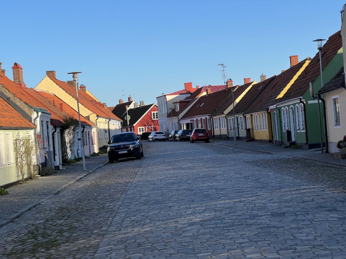
Another colorful street

A door in Simrishamn

Another door.

Notice the similar patterns repeated in the doors?
Apparently this is a regional similarity.


Our fourth day of the hike, April 12, would take us along the coast again from Simrishamn to Kivik and would be our longest official day of hiking at 21.8 kilometers (13.5 miles). We began in front of the hotel, walking north between a river and the sea, eventually going somewhat inland to hike the length of Stenshuvud National Park, return to the sea at Kivik where we would walk through the village to our night's lodging.
Our hike day's hike began here, across the street from Hotel Svea.

At first we thought these clumps high in the trees were like mistletoe.
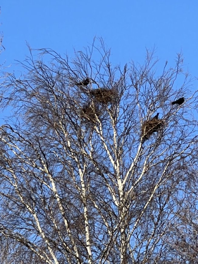
But then we realized they were bird nests.

Along the river.


Looking back toward Simrishamn.
Looking ahead with our trusty orange square to guide us.


Here our path goes through some rocks.

A rock cairn built along the trail.
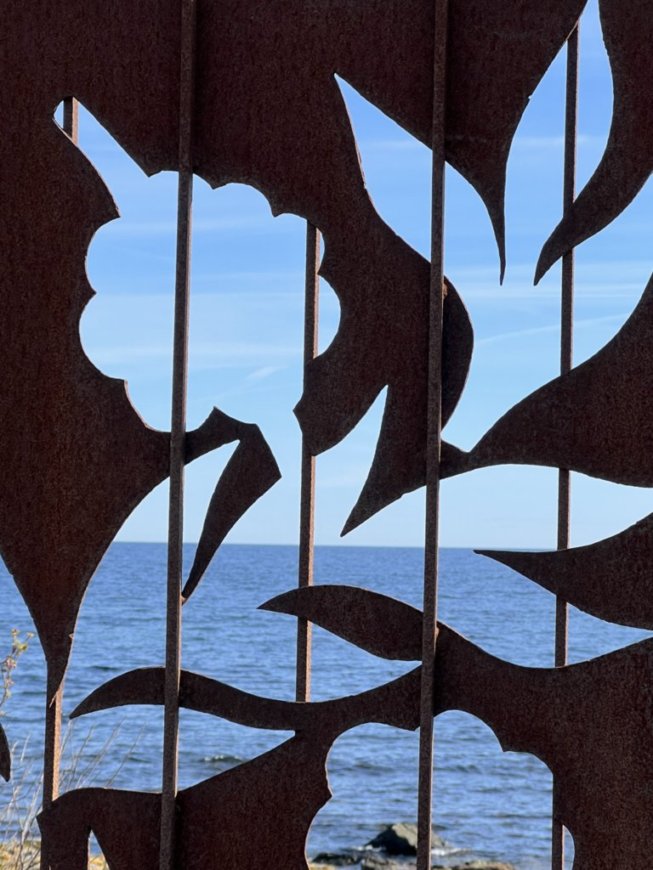
The sea and sky as scene through a piece of metal art along the trail.

Which way? To where?
Another piece of trail art.


A fishing hut.

Some tree blossoms - we didn't see many - too early!

Sheila could not resist climbing this tree.

Even though this sign was broken, we could tell this was a right angle turn.

The country road we walked along for awhile before getting to the national park.

More of our country road.


The mirror is for helping drivers see around the corner.

Ready to enter the national park.

Sheila standing by our lunch rock.


A rock wall in the park.

The very informative visitor Center at Stenshuvuds National Park.

Part of a story telling diorama in the Visitor Center.
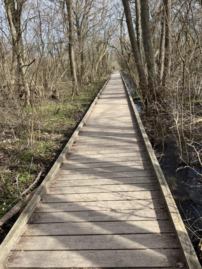
We walked through a wetland on this boardwalk.
We realized we had left our orange marked trail and retraced our steps. This was the only place on the hike where we got at all confused about which way to go, but it was only a short detour.

Stenshuvuds means "Stone Heads."
There were three heads of rock outcroppings almost 100 meters above the sea.

Pretty flowers and trees along the path.

A big tree.


View from the east head.

Sheila at the high point.

Steps going down.


A flowering Forsythia bush in the front yard of a house on our way to Kivik.
I grew up with a Forsythia bush in the back yard in Grass Valley, California.

I had never seen them in other parts of Europe, but Sweden has lots of open space.

Angakåsen stones along our path.
This was another example of "ship stones" like those at Ales Stenar, but obviously not as famous since nothing in our guidebook mentioned them, but we saw them and explored a bit.

Another view in the stones

Looking from inside the "ship."
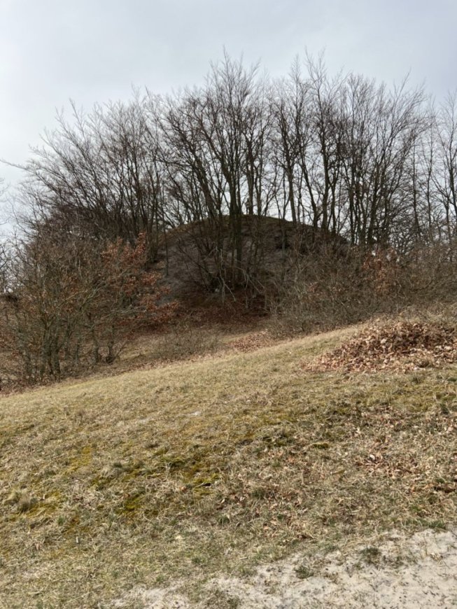
Kiviksgraven (Kiviks Grave) - a landmark that was mentioned.
This is the site of one of the largest Bronze Age tombs in northern Europe.
We couldn't get closer because this area has become unsafe to walk around.

A cafe over an old mill site at Kivisgraven - still closed for the season.

A house in the village of Kivik.
After reaching the harbor, the end of the day's hike, we walked a ways through streets to reach our B & B. Something we had noticed previously was that very few houses had any overhangs or entrance areas at the front door. I thought this rather strange in an area that gets cold, windy, rainy weather. Here in Kivik there were many houses with roof coverings over the door or entrances like this one.
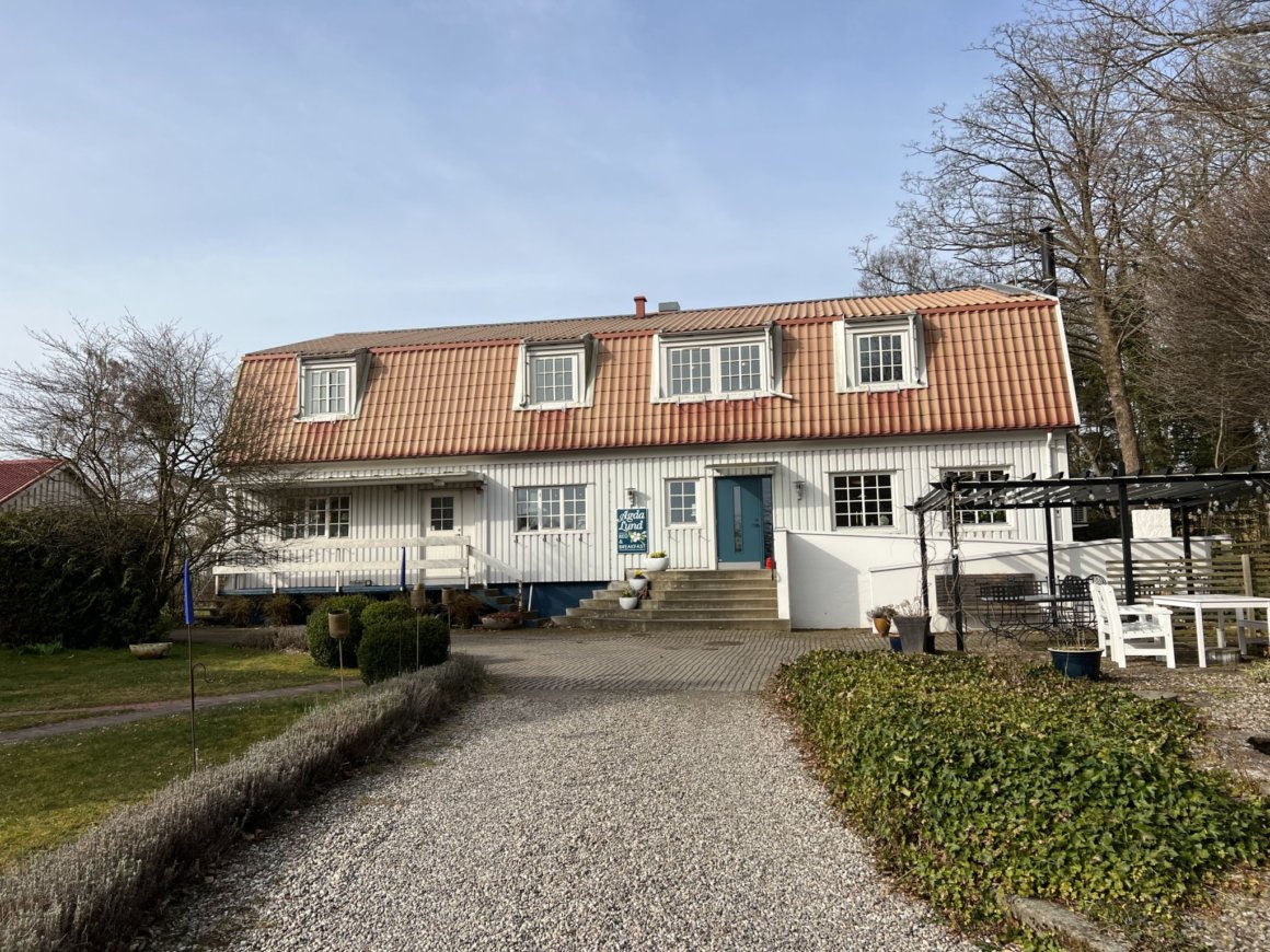
Agda Lund B & B - our home for the night.


Easter feathers in a potted plant in the dining room.
On Wednesday, April 13, we would leave Kivik to hike along the sea for a while before finally turning inland and heading east to the village of Brösarp. Following our longest day of hiking, this would be our shortest at 11.7 kilometers (7 1/4 miles).

Looking back to Kivik as we began to walk along the sea.

We learned that 75% of Sweden's fruit is produced in this region.
We had wonderful natural apple juice from local apples.

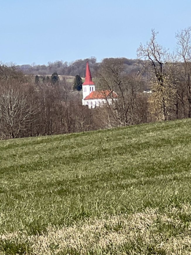
A church along our way.
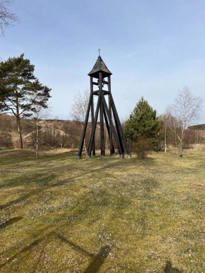
The church's bell tower.
This type of Bell Tower is much more practical than the the large, subject to leaking bell towers on top of churches like at Eureka First United Methodist Church in California.

Pretty and interesting buds on a tree.

Bird prints in the beach sand.

A pretty evergreen tree.

An evergreen forest in an area referred to on an interpretive sign as "old growth" forest.


Sheila, not sure she should enter, was too intrigued not to try.
Later reading the interpretive sign in Swedish, which neither of us read, we realized it said we were welcome to enter.


Fishing nets to the left, hooks, etc. to the right, Sheila in the back signing a quest book, and the loft up above.

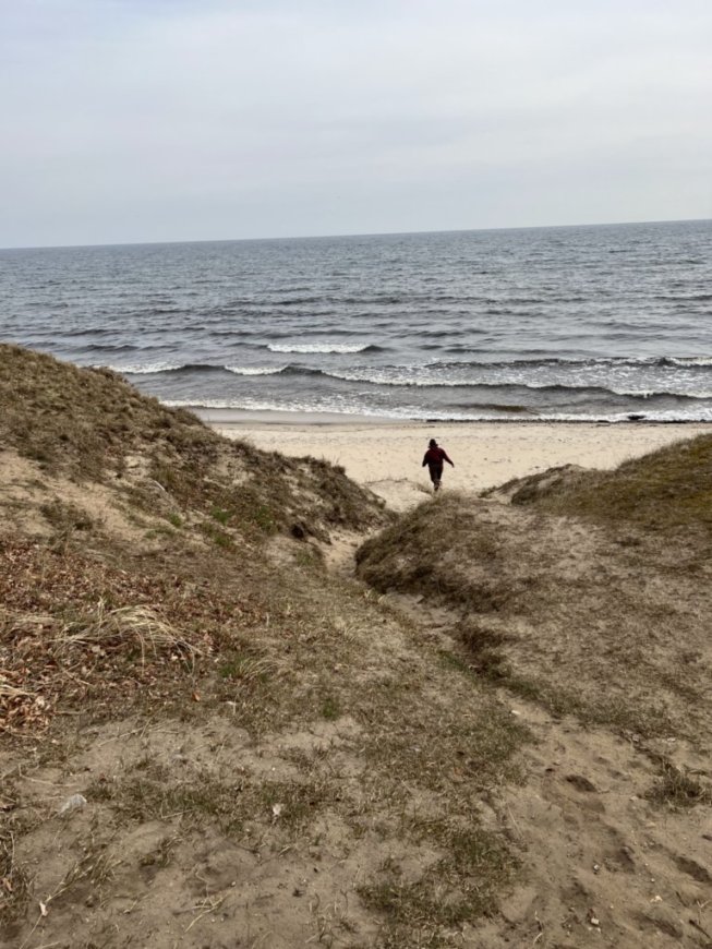
Can you see Sheila up on the hill?

Zoomed in with my phone camera from the same vantage point as the last photo.


Looking at the grave from the other side.
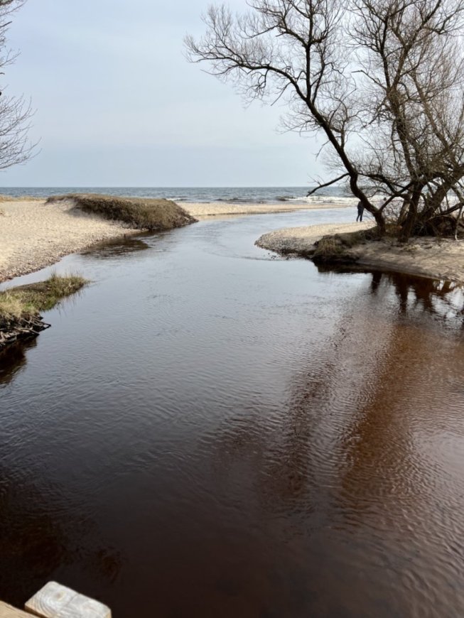
Sheila going down to the sea from near the grave.
This was where we would turn inland and leave the sea.
Sheila and I had both said we would put our feet in before turning away from the sea, but at this point I stayed up above, not sure I'd do it.


As we prepared to turn inland we had a choice between staying on the orange marked Skåneleden Trail or choosing a yellow marked Backaleden Trail. The trails ran parallel to each other on opposite sides of a river and were just about the same length. We felt some loyalty to sticking with our orange markers, but were also curious about the Backaleden trail which had a detailed brochure at the beginning, in English, and was 19 kilometers long - we could complete the entire trail over the course of the rest of this day and the next. We finally decided to follow the yellow markings, and were not disappointed - though I'm sure we would not have been disappointed if we'd stayed on the orange trail. Either way we wouldn't know what we were missing.

Horses in the first pasture we entered on the Backleden Trail.
This was the first time we'd been in a pasture with animals, though we had crossed many pastures over the past 4 and a half days.

This was a museum along the trail.
When we entered the lights came on and we were able to look at many displays of life in former times. I've never seen a museum like this, or the fishing hut earlier, that allowed one to enter without an attendant being present.

A display

A relief map showing where we were hiking.

A wild boar.


Another country road that doubled as our trail.

We would pass through lots of farmland on this day and the next.

And more farmland

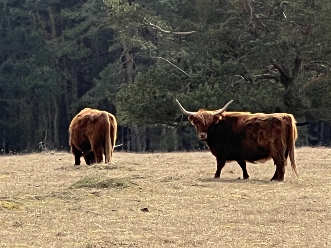
Long haired and long horned cattle curious about us as we crossed their pasture.

A walnut shell on the ground.
We saw many of these on our hike, and there often no trees of any kind nearby, and certainly not walnut trees. And of course it wasn't walnut harvest season. Were they a common snack of hikers, or did birds drop them as someone suggested?


A sign at the top of a stairway on the trail.
Signes trappa means Signe's stairs - Signe is the name of a good friend, a name I've never known attached to anyone else - so here are her stairs!

A house near the bottom of Signe's stairs.

A farm building with water cascading below it.
The orange and yellow trail merged here to enter Brösarp where we would find our hotel.

Easter feathers along the street.

Eurasian Magpies

Brösarps Gästgifveri, our hotel.
A sign on the front of the hotel.
 i
iThis knitted cutie greeted us in the hotel lobby.
We weren't sure what she represented, perhaps a Scandinavian "kitchen witch," or maybe Kerstin. A trail guide told us about Kersin, who was the last person to live in the "Executioner's" house. She made whisks and sold them in the nearby village. We walked by the site of the legendary "Executioner's" house on the following day. Information said that it was unclear whether an executioner ever lived there, but there apparently was a gallows only 2 kilometers away that had been used for executions into the early 1800s.

A weird effect looking down a hall at the hotel.
The front of the hotel was pretty old, but this hall was in the back where a newer addition had been built. Our room was in the back. with a view of the parking lot, but it was a perfectly good accommodation.
The dinning room where we would have breakfast.
After checking in at the hotel we went out to explore the town a bit. We found dinner at a Lebanese food truck not far away. The only gift shop we found open was all British goods, so other than our dinner we didn't find much place to spend our money.


The Brösarp Church.
We had hoped that since it was Holy Week we might find a church we could drop into a service at, but our timing didn't work. We were here at this one on Wednesday evening. We saw a notice for a service on Thursday evening, but then we would be miles away at Alunbruket where we would see a sign inviting folks to attend a Maundy Thursday service at the Brösarp Church.
We thought at first these decorations along the street might be representing the women going to the tomb of Jesus since we were here during Holy Week, but they were holding whisk brooms, so we're not certain what they were - maybe "kitchen witches?"
Friday, April 14, would be our last day of hiking, and it would be another short day. We continued on the yellow marked Backaleden Trail from Brösarp to Alunburket for another short day of 11.8 kilometers (7.3 miles). We were sad that our adventure in Sweden was coming to an end, but also looking forward to joining family in Cyprus where Sheila lives. And there were still many new sites to see.

Walking by a neighborhood.
The Volvo tractor is a clue that this is in Sweden.


Pretty star shaped moss.

A pretty creek we walked along.

The path along the creek.

A bridge we would not cross.

Mushrooms on a tree.
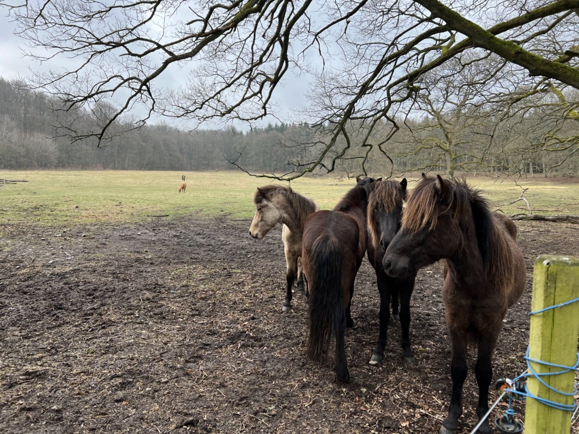
Some ponies that came to the fence looking for a handout that they didn't get.
To be continued in Part Three...


Love going on your trip!
ReplyDelete