Beginning to Head West: Georgia to Texas

Resting on a trail at Davis Mountains State Park, Texas
I devoted my last blog to Florida, and this one should probably be up to Texas, and I should leave Texas to its own space, but here goes: We are truly headed west now as we left Florida, drove through a small corner of Georgia, spent a couple of days in Alabama, made a quick trip to the Florida panhandle for lunch, and then headed on to Mississippi, a one night stop in Texas, a night in Oklahoma, then 6 more nights in Texas.

We drove through a corner of Georgia on our way to Alabama after leaving Florida.
On our way south from Maine to Florida we did spend one night in Georgia, but it was at a Cracker Barrel - it's the one state we didn't get much of a unique sense about as we have from all the other states we've been in. I had wanted to go to the Jimmy Carter Center, but we were eager to get to Selma to see our grandson Alex on the weekend.


Generation Ridge - our Harvest Host site in Alabama on Friday, October 28.
Our host here at this working cattle and chicken ranch was a 26 year old young woman - one truly amazing person! Cattle and chickens have been a part of her family's livelihood for a couple of generations, but this enterprise is hers. She is the one managing this business and doing most of the work, and carrying the farm loan. Currently she has about 60 head of cattle, but the most amazing thing is the chickens. She has 4 huge chicken barns, built just a few years ago, that house over 49,000 chickens in each barn - that's almost 200,000 chickens! She raises them, with the help of state of the art equipment including automatic feed and water systems, until they weigh 5 pounds each and then they are picked up by a transporter that takes them to a processing plant where they eventually end up at the fast food chain Chick-fil-A. She gets 30 cents a pound for them and after a break of a couple of weeks she gets another batch of chicks to raise up to 5 pounds in 42 days. It's a highly regulated industry with weekly inspections, and stringent guidelines.

A view of the four chicken barns.

Where we parked for the night.
The barn behind LesThora is an event venue where weddings, family reunions and other events are held. Most Harvest Host locations have something to sell, but not this one. Shelby, our host, just likes to share this location with travelers. We won't soon forget our time at Generation Ridge!

Sunrise as seen through the window on Saturday morning.
Scott's youngest son Alex works for FEMA and is currently assigned to a depot in Selma, Alabama. As a temporary FEMA employee he's got a real sweet gig - great hourly pay, a hotel room, rental car and generous per diem pay. For a young person with no family of his own, you can't beat this job. The longest he can stay in one spot as a temporary worker is 50 weeks which he will reach at this location in December at which time he'll either join his parents in Maine, or head to an Air B and B for a few weeks as he waits to be called up to another location. This is Alex's fourth assignment since he joined FEMA almost 3 years ago, and we have managed to see him at each location he's been assigned to: Jackson, Mississippi; Carson City, Nevada; Maryland; and now Selma, Alabama. His work in Selma involves moving things around with a fork lift. The main thing this depot supplies to disaster sites is trailers that get sent here from where they are manufactured and then distributed to where they are needed in the country. There is a good chance Alex's next assignment will be in Florida to deal with the aftermath of Hurricane Ian.
We enjoyed lunch, sightseeing, dinner and of course board games with Alex. We camped at the Selma Flea Market RV Park which was actually a very simple and pleasant campground.
Here we are, me, Rob and Alex, and the Edmund Pettus Bridge.
This is where "Bloody Sunday" happened on March 7, 1965 and brought national attention to the Civil Rights movement.

Under the bridge.
We later learned that this is not a very safe place to be - sketchy neighborhood.

Monument to John Lewis who led the Selma to Montgomery March, and who was savagely beaten on "Bloody Sunday." Our son Shawn has worked with John Lewis in the past, and walked across the Edmund Pettus Bridge with him on a commemorative march.

Brown Chapel, currently being rehabilitated, where the March was organized and began.

After leaving Selma on Sunday we made a quick trip to Pensacola, Florida for lunch with my nephew.

And then back through a bit of Alabama before entering Mississippi.
I missed getting a picture of the Welcome to Mississippi sign.

This would be our stopping spot on Sunday, evening, October 30.

Pretty Lake Perry

Another part of the lake.

Here we are nestled in the trees - seemed like a pretty ideal site.

Except for the bright street light that shown all night!
Really!!! We've had darker nights in a Cracker Barrel parking lot!

Sun rising behind Lake Perry.
Notice the alligator sign...

Another view of sunrise at Lake Perry on Halloween morning.

Crossing the great Mississippi, which is experiencing the effects of a drought.
See the sandy beach across the river under the bridge...
Just before crossing the bridge we stopped for lunch at Vicksburg National Historic Park, the site of a very strategic Civil War Battle as both armies fought for control of the Mississippi River. We learned that the towns people took cover in caves where they lived out the duration of the battle.

On this cross country trip our goal was to spend at least one night in each of the 14 of the lower 48 states that we missed two years ago. There were actually only two of those states that both of us had never been in before: North and South Carolina. We've been to New Orleans in the past so this time we opted to go further north in Louisiana as we made our way toward Oklahoma. We only spent one night in Louisiana, but we discovered lots of interesting history there in Monroe where we stayed at the Chennault Aviation and Military Museum - a free Harvest Host site complete with an electrical hook-up. From our "camp site" in the museum parking lot we took a short walk on Monday evening, October 31, to the Monroe Municipal Airport and learned in the displays there that Monroe, Louisiana is where Delta Airlines began as a Crop Dusting operation, the largest navigation training center in the U.S. during World War II was also in Monroe, and it was a Monroe native who first bottled Coca Cola. There is a Coca Cola museum across town, but we didn't go to it. We learned lots more details about the history of Monroe, especially its military history, on a free guided tour on Tuesday morning at the Museum.
After leaving our very interesting stay in Monroe, Louisiana on Tuesday, November 1, we headed on our way to Oklahoma. We made it as far as a KOA in Texarkana, Texas. This town on the border of Texas and Arkansas was pretty unremarkable, at least in the bit we saw, and I took no pictures there. We did get laundry done and good showers though. Wednesday, November 2 we arrived in Oklahoma, and found a beautiful spot to camp on the shore of Lake of the Arbuckles in Chickasaw National Recreation Area near the town of Sulphur, Oklahoma. At the visitor center in town the next day we learned of the very interesting history of the area and how the Chickasaw tribe offered to sell the hot springs there to the federal government as a way to protect them for the future use of all people. The only catch? Name the area after the Chickasaw tribe.


Yellow fall colors near our campsite.

A long row of ducks on Lake of the Arbuckles.

Back into Texas on Thursday, November 10.
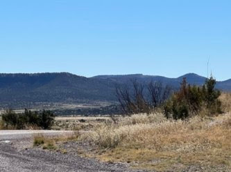
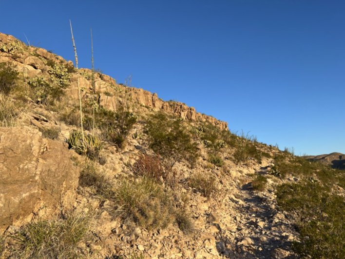
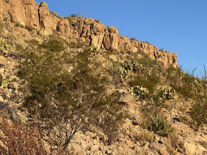
We have been to Texas in the past, but not in the RV. We went to Scott's graduation from basic training in the Air Force 30 years ago in San Antonio, and spent a couple of days there, and truly enjoyed that city. When Scott and his family were later stationed at Dyess AFB near Abilene we flew to Midland and from there Scott flew a rented plane to transport us to Abilene. We did some interesting sight seeing then, but generally thought of Texas as pretty flat and uninteresting. Our first day of driving in the state didn't change that impression much, but we appreciated the hospitality of the small town of Hamlin where they offered a free RV park, and Rob found a book at a free library on the way there in the town of Haskell when we stopped to take a break and walk around. On our second night we camped at Monahans Sandhills, and by then I was starting to fall in love with West Texas, and it only got better when we approached and then stayed two nights at Big Bend National Park followed by two nights at Davis Mountains State Park.

Downtown Haskell, Texas.
Hamlin's barebones, but with electric hook-up, free Rv Park.
The history of this town, as recorded on a plague downtown said it was founded as an agricultural and railroad town, and there is definite evidence of that still there, with cattle feed lots along the highway as we approached the town. But on my early morning walk what I noted was all the businesses focused on hunting: An outfitter's store boasting that it had all the supplies a hunter needed, a taxidermy shop, and a business devoted to processing the meat from the hunt.

Sunset in Hamlin.

A metal sculpture of a buffalo on the side of a building in Hamlin.
There were also several murals on walls, but also many boarded up businesses.
This was one of many towns that appear to have seen better days.

The entrance to Monahans Sandhills that we happily reached after two days of very windy conditions.

A different, somewhat surreal, and beautiful landscape.
More than once when we'd glance out the window we'd first think "snow" when we saw the white sand.

A very large katydid I spotted on the road as I explored on Friday afternoon.

Some of the rippling sand.

Pretty yellow flowers in the Sandhills.

More vegetation.

An historic section house built in 1903 used to house a railroad foreman.
These houses were placed every 20 miles along the track.

Foot prints in the sand.

More ripples.
On the way to Big Bend National Park.
The closer we got, the more enthralled with the scenery I became.
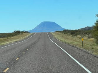
A mountain before us.

More desert beauty.

I was in love with this place even before we entered.

The Chisos Mountains reflected in a window at Persimmon Gap Visitor Center.
I did a double take as I approached this window - the reflection was so clear and crisp.

Part of the Chisos Mountains that were being reflected in the window.

Cactus in front of the Visitor Center.

The hat pin I bought at the Panther Junction Visitor Center.
There was more than one design of pins to choose from, but I settled on this one with a Black Bear because of their interesting success story at Big Bend National Park. Black Bears were common in Big Bend in the early 1900s, but by 1944 when the park was established there were virtually no bears left due to shooting, trapping and loss of habitat. But as the story goes, sometime in the late 1980s, a female black bear left Mexico, swam across the Rio Grande and moved into the Chisos Basin at Big Bend. We didn't see any bears while we were there, but I did hear someone talking about having seen one when they were hiking in the mountains. This story makes me happy in many ways, and I think the bears will do well there and not become the problem they have become at Yosemite and Lake Tahoe. The park is doing everything it can to not habituate the bears to human food. Unfortunately years of mismanagement and carelessness in the past in regards to the bears in Yosemite and Lake Tahoe have contributed to the problems there.

This tarantula we saw outside the visitor center was a critter we're not used to in California.

A tunnel on the road to our campground at Rio Grande Village.
Up until Saturday morning when we were driving toward the park I wasn't sure we had a place to spend the night. The regular National Park campgrounds were full, and when I had called the RV campground with hookups prior to heading to the park their electricity was down and they couldn't check their computer to find out if there were any open sites. When I called on the way there Saturday morning the electricity was again working and they had one site available which we were able to get for two nights. Big Bend is pretty isolated and it would have been a long drive out of the park to find some where else to stay.

The mountains in the back ground are Mexico.
This interpretive sign, and many others in the park, speak to the permeability of the border between Mexico and the U.S. in regards to plants and animals and also humans. There is no "Wall" here and the only official border crossing is through the river. One can walk across when the water is low enough or hire a row boat ferry.
The striated cliffs in the background are in Mexico with the Rio Grande between it and the ridge in front of them. We could truly feel we were in a "Big Bend" of the river with Mexico to the West, South and East of us.

Our first glimpse of the Rio Grande River - didn't look very big!
This was less than a half mile from our campsite.

The beginning of a nature trail about 3/4 of a mile away from where we were camping.
This float dock and bridge accommodate the fluctuating level of the water, partially due to beaver dams.

A view of the river from part of the nature trail.

I came upon this display of items for sale along the trail.
There was no "sales person" visible, but there was a jar to receive money.

The first cow I saw while we were at Big Bend.
The cattle, and horses apparently, wander back and forth across the river.
I guess you could say their "home" is really in Mexico.

More cattle curious about me as I take a spur trail to the river's edge.

Mist rising off the Rio Grande River in the early morning.
That's Mexico on the other bank.

Looking to the west past some cactus.

Another view of the mountains in the west.

And a closer up view of those mountains.

Looking south east into Mexico.

Looking west from an overlook on the nature trail.
The white structures to the right of the river are in the campground.

The buildings on the ridge are part of the town of Boquillas.
On Sunday, November 6, our only full day in the park, Rob and I rode our bicycles to explore the end of the park road near where we were camped - about 4 miles from camp. Along the way was the overlook where I took the previous picture of Boquillas, and the next one displaying handmade items from Mexico for sale. In the park newsletter we had read that it is illegal to buy goods from persons selling these items while in the park, but what we read also indicated how to cross at the border crossing and that it was perfectly fine to buy things in Boquillas and bring them back to the U.S. What I found interesting was that though there was written information in the Park newsletter to indicate the illegality of buying items in the park, clearly authorities look the other way. There were lots of places with a few items along a trail with a jar to receive money, and then there were places like this one pictured below with lots of things for sale. Only one time did I see a man on a horse near one of the displays who was obviously connected to the goods being sold.

The separate groupings of items had separate receptacles to receive the money - obviously they were being sold by different individuals.

The river's entrance to Boquillas Canyon at the end of our bike ride.
The river isn't quite visible in the picture, but the gap in the center is where it enters this canyon.

Looking out to the river not too far from the border crossing.

A sign on the fence near the border crossing.
We rode our bikes into the border crossing area, but didn't go in the building.
It looked closed, but there were lots of cars in the parking lot even though we didn't see or hear anyone.

Pretty purple flowers near the border crossing.

Rob "zooming" down a hill in front of me.
It was a truly beautiful day for bike riding with hardly any traffic, and perfect weather. Rob usually rides behind me, but this time as we were going up the hill before riding down this side, he passed me - he never does that. Later he said it was because he didn't want to loose momentum, but I think it's because the little boy in him wanted to ride faster down the hill than I ride. If he's behind me going down the hill, I think he has to slow down more than he likes because I brake too much.

Back at camp we saw this pretty coyote go by a few times as we sat outside and read.

Moon rise as seen from the nature trail we walked to at sunset on Sunday evening.

Looking west after sunset.

A bobcat that crossed my path.
This was early Monday morning when I walked the opposite direction from the nature trail.

Part of the old buildings at Daniel's Ranch where the road ended going west from our campsite.
There is a trailhead there and I wanted to walk up part of the trail before we left camp.
Heading up the trail.
Looking up the hill in the early morning light.

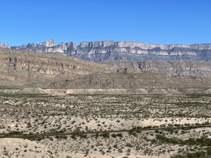
A view into the Mariscal Canyon from an overlook on the trail.

Another view into the canyon from that overlook.

A trail sign near the overlook.
I would love to have followed the trail another 2 miles to the Hot Springs, but I had to return to Rio Grande Village for breakfast and to break camp as we headed out to explore another part of Big Bend.

Santa Elena Canyon - our destination on Monday morning on the western side of Big Bend.
The Rio Grande River cut this 1500 foot deep canyon that is 30 feet wide at its narrowest point.

Heading out for what was supposed to be a 1 1/2 mile round trip to see into the canyon.

But when we got to the creek, it wasn't dry like some had said it probably was.
There was a place to cross up stream a ways where you could stay dry, but when we walked up there we could see that the footing on the makeshift trail on the other side was not good so we opted not to cross.

Looking into the canyon from the beach down stream.

Driving past the Chisos mountains on our way north.

Another view from the same spot.

And another view of the Chisos Mountains.
We could not drive into this mountain part of the park because the road there isn't designed to accommodate a vehicle as big as ours.
On Monday, November 7, we drove out of Big Bend National Park heading north toward New Mexico. I was sad to leave this beautiful place behind. Something about the landscape and location of this park really touched my soul. I can't fully explain it, but it was truly beautiful and awe inspiring, and we only saw a fraction of it. This desert landscape reminded me some of Nevada, another desert landscape I have come to love, and maybe there's a good reason for that because eons ago they were part of the same inland sea. I hope that some day I'll get to return.
We had considered staying in the Big Bend area and heading to Big Bend State Park up river from the National Park, but once out of the park we decided to head north toward Guadalupe National Park. We managed to get a camp site at Davis Mountains State Park, and it is another stellar location in the great state of Texas!


Our campsite

Sunrise at Davis Mountains State Park, Tuesday, November 8, 2022.

The beginning of my early morning hike on Tuesday, November 8.

Pretty grass along the trail.

Looking out near the top.

Pointing to the overlook at the top.

A panoramic view from the overlook.

A bench at the overlook - the campground is in the green space to the right.
The white building in back is the Indian Lodge.

An interesting looking rock on the trail.

Where we turned around on the trail - it got real steep from this point forward.
Going up would be OK, but coming back down didn't appeal to either of us.

Looking down at the bench we'd rested on on the way up.
The picture of us on the bench is at the beginning of this blog post.

A pretty pink flower on the trail.
Only saw a couple of these - November is pretty late for flowers.

Looking across the Davis Mountains to the flat land beyond.
This was a beautiful park to spend two nights in:
electricity, nice campsite, beautiful vistas,
and most important to me were the trails that started right in the campground!
Wednesday morning we headed north toward Guadalupe National Park. Since we weren't able to get a reservation in the park we didn't plan to spend a lot of time there, but we enjoyed our short visit and learned some interesting history of the area.

Approaching El Capitan, the most visible feature of the Guadalupe Mountains.

Entering the park.

We went for a short hike.
I yearned to hike into and up those mountains but it was not to be.

Some fall color in the desert landscape.

A Serendipity of our time at Guadalupe Mountains National Park was the trail leading to these ruins.
There was a short trail behind the visitor center that it took awhile for me to find, but when we did we discovered some interesting history there: The Pinery, or "Pine Spring" Stage Stand. It was built in 1858 as a station on the overland mail route from St. Louis to San Francisco. The information we read said that this stage route was the first time mail went across the country by land. Prior to that it had to go by ship all the way around South America.
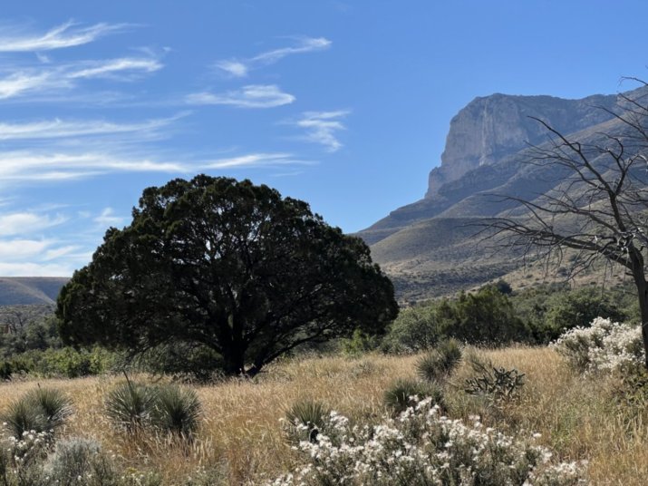
A beautifully shaped tree with El Capitan in the background.
To the right of El Capitan is the highest peak in Texas, Guadalupe Peak at 8,751 feet.

A tree that caught my attention along the Pinery Trail.
I wondered, was it Manzanita or Madrone?

Close up of that tree - found out it is Texas Madrone.
We'd entered Texas with a mostly negative feeling about the state, but after several days there I was smitten with west Texas, especially Big Bend National Park. I wouldn't mind visiting there again in the future!
On Angel Island in California:

Straus posing nicely - isn't he pretty?

Elsie appearing to scowl!


looks to me like you have a different calendar than I do... two different spots where you stayed on 31 Oct... LOL
ReplyDeleteYou should have put Houston on your agenda and the southcentral jurisdictional conference... History was made there. On the first ballot it elected the jurisdiction's first woman bishop, another woman variously described but spanish speaking and the first native american for our college of bishops. And in the first worship of the day, Bishop joins admited that he had been hard-headed about somethings (he didn't say what) and I think he said he'd been wrong that he should have been listening more to god. I'm not sure it was an apology, particularly because it wasn't specific but from my many years serving under him (and earlier experiences) I think this is about as close to an apology as anyone will get from him. You can watch that sermon on You tube and form your own opinion. And the pastor of Lovers lane UM chuurch in Dallas asked for a rebuke of 3 of the bishops of the Jurisdiction for their part in supporting and (I forget the other word maybe encoyuraging) the formation of the Global Methodist CHurch and asked all the folks leaving to voluntearily step down from the UMC responsibilities. And then a group from the jurisdiction put forth an apology to the western jurisdiction for their behavior in opposition to the election of Karen. I acan't remember if that was a proposal that was then adopted by the conference. But all of that mostly in one day... History and signs of of a new wind blowing.
ReplyDeletethe apology was specifically to Karen and Robin and the Jurisdiction
DeleteSo much beauty! Even the cats...
ReplyDelete