A New Year, New trails, New Trilliums, New Elephant Seals!

Happy New Year from my First Day Hike.
The best way to start a new year is with a good long hike!
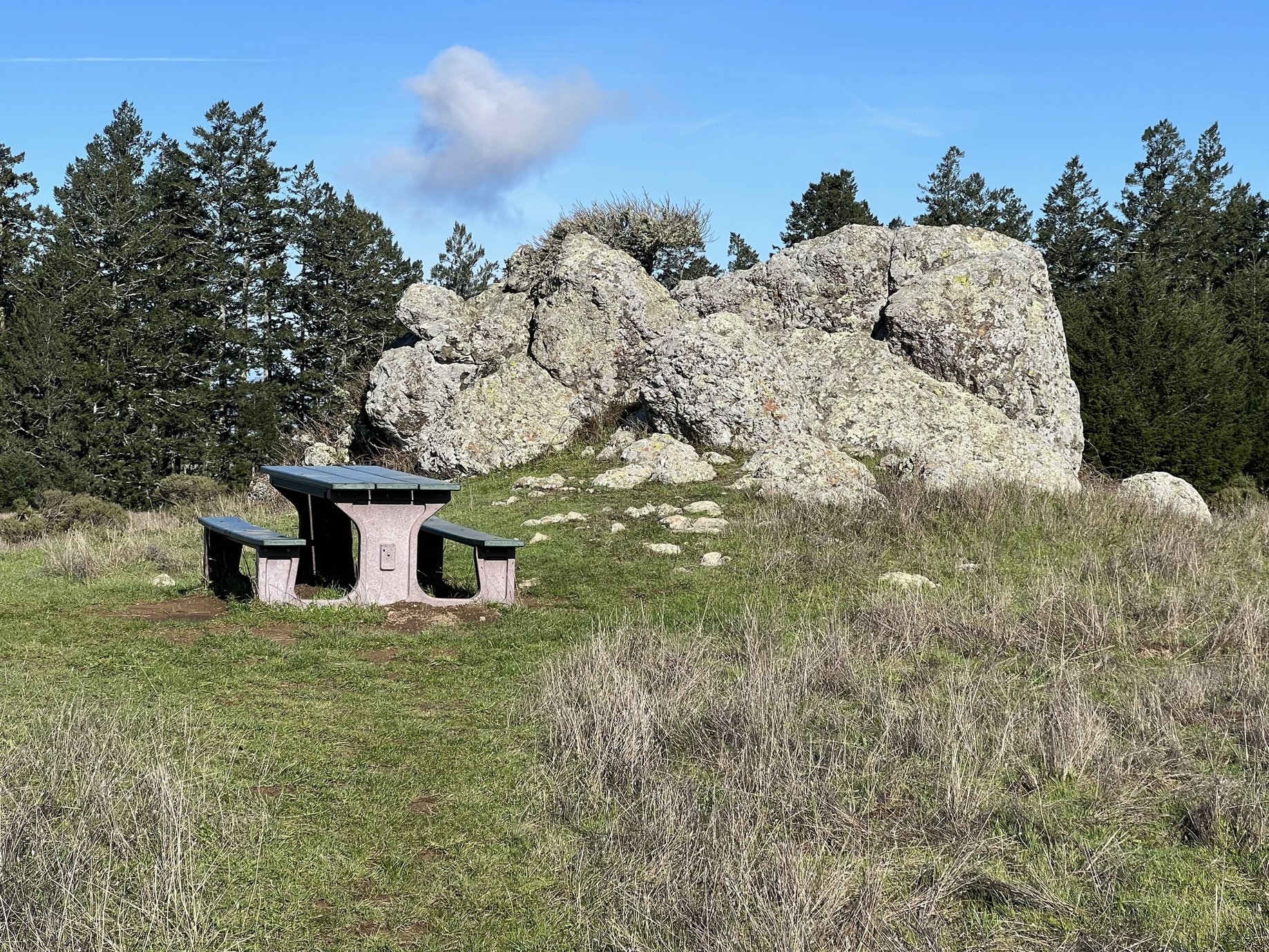
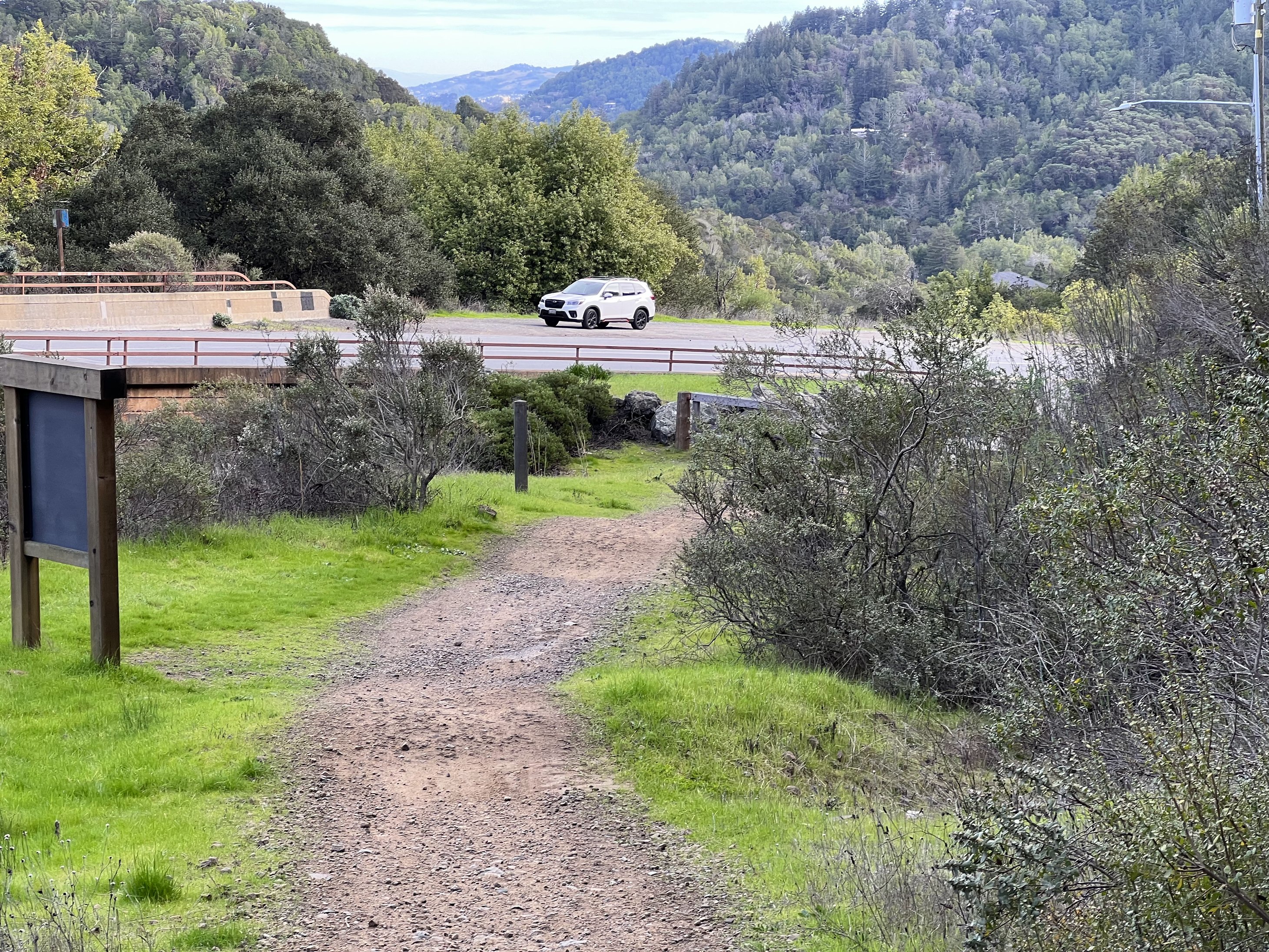
January 1, 2024 dawned with perfect weather to take a nice long hike. I picked up where I left off last spring on the Bay Area Ridge Trail. Though we've been in Marin County since November 1, this was my first out of park hike. This particular hike on the Bolinas Ridge Trail is not that easy to get to. The trailhead is only 19 miles away by car, but the last few miles on the Bolinas Fairfax Road are not for the faint of heart. It is paved, but windy, narrow, and with steep drop offs. I had hiked south from this trailhead last spring and Rob and I were not looking forward to driving there again, but we did it on January 1, so I could walk back to camp from there. It was about 12 1/2 miles long, but with little elevation gain, mostly down hill as it followed the ridge before dropping down on the Jewel Trail to the Cross Marin Trail and then right back to our campsite.

The trailhead, January 1.

Hiking through second growth redwoods.

Some fog "trapped" in the woods.

A beautiful New Year's Day view of the ocean across Stinson Beach.

A "peak" view to the north east.

Another view north.

And another view North east.
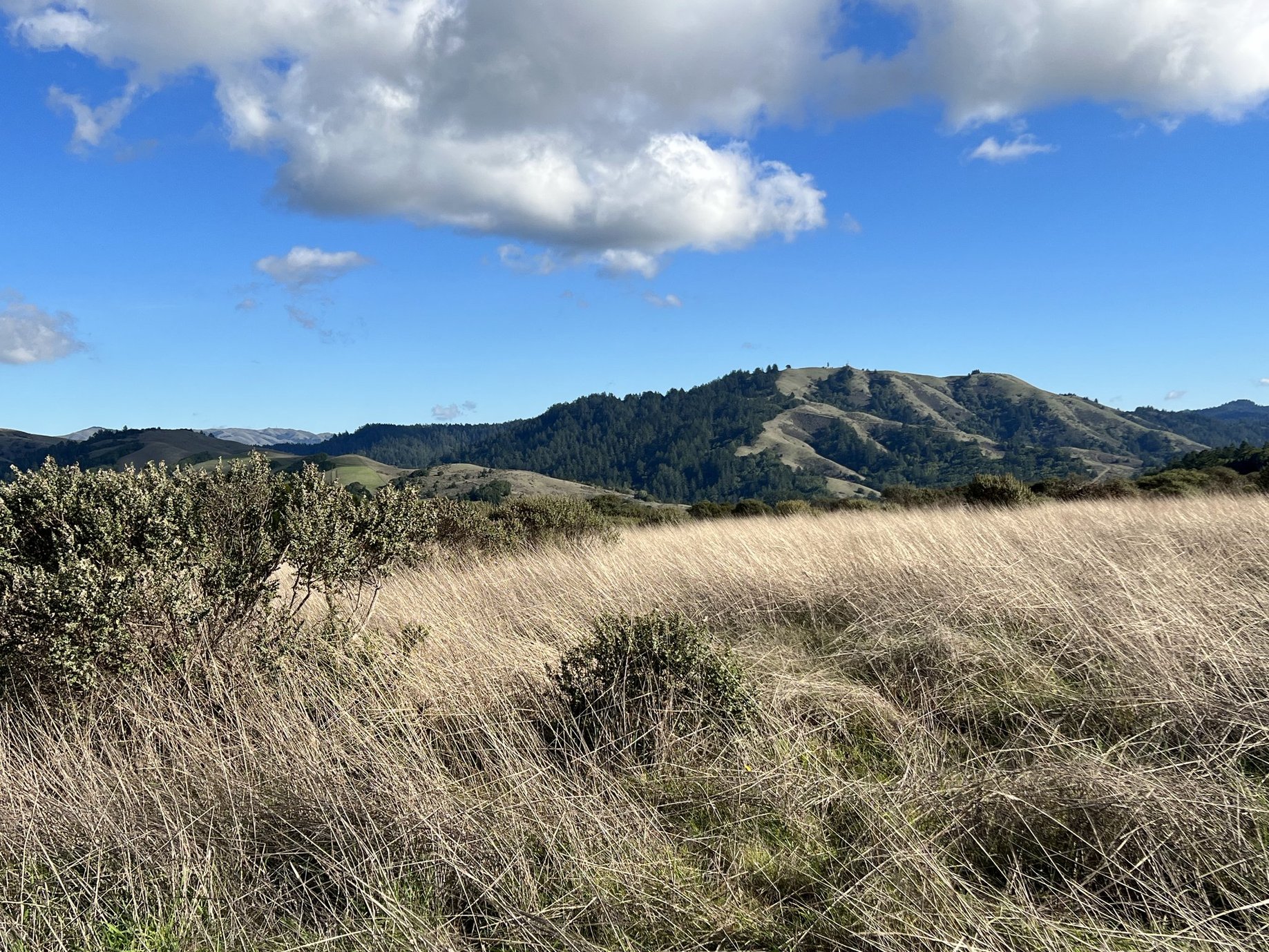
The first half of the hike was forested so not many long distant views, but beautiful!

One of a few water hazards I had to navigate.
Actually the trail was less wet than I thought it would be.

Beautiful walk on the upper Bolinas Ridge in the Redwood trees.

Manzanita blooming on January 1!

A water tower on the trail - don't know where the water was for.

The first trail junction I came to, but well marked directing me forward.

Another well marked trail junction.
This was the first place I saw another human - a hiker coming up the trail.

Continuing on.

Trail junction with Shafter Grade to the right.
I have hiked this section before, both up and down Shafter Grade.
I could have gotten back to Camp Taylor via Shafter Grade in a shorter distance than continuing on Bolinas Ridge, but it is a VERY steep trail, worse going down than coming up.
A resting spot not too far from the top of Shafter Grade.

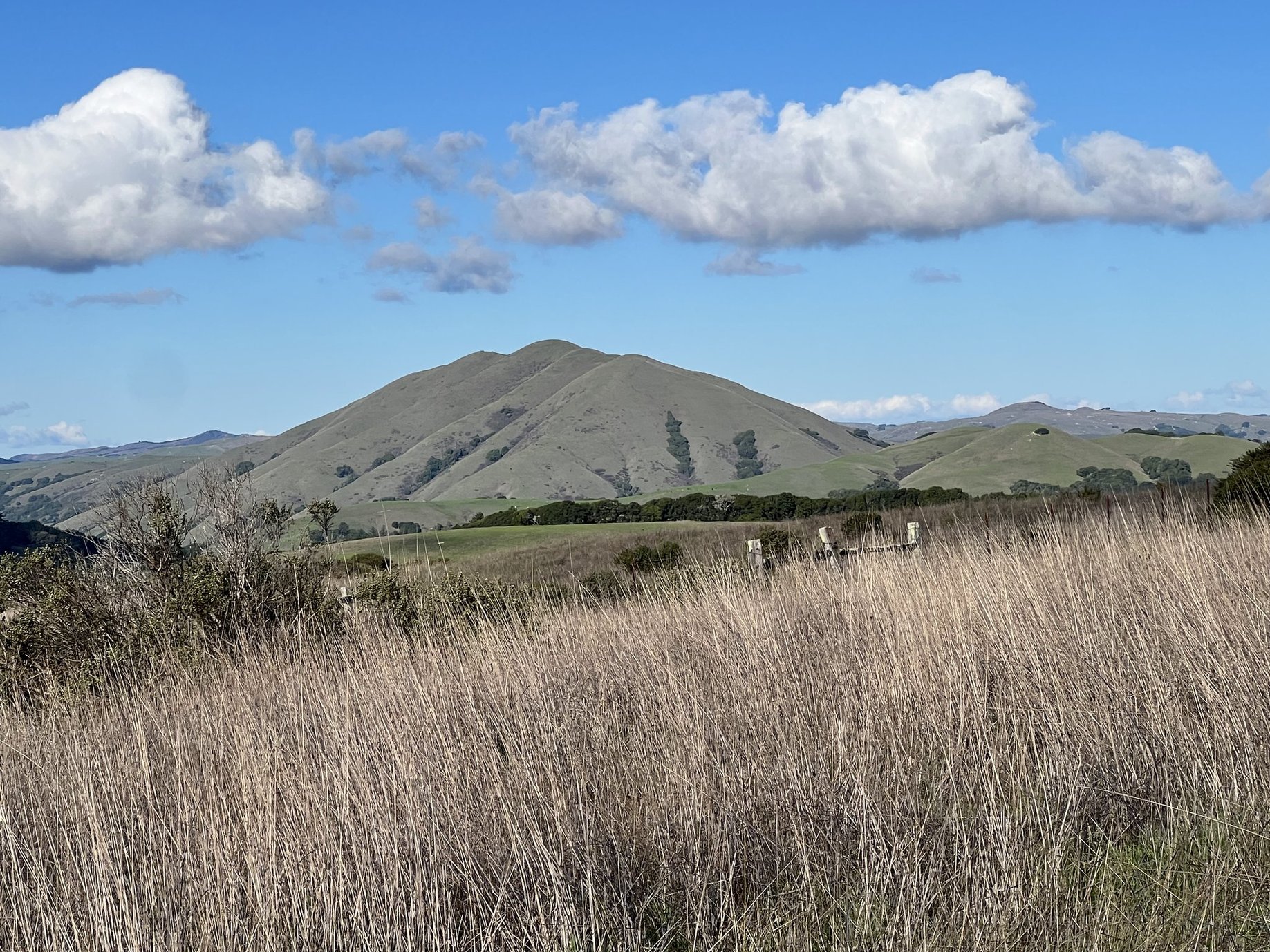
Looking out to Tomales Bay.
The trail here is in open agricultural land now, not too many trees.

A wet spot by a giant Eucalyptus tree, probably 8 feet in diameter.

Getting closer to Tomales Bay.

Some cows on the trail.

Cute calves reminding me of my 4-H days raising Black Angus cattle.

Another view of Tomales Bay.
Looking to the hills north west of Bolinas Ridge.

The little town of Point Reyes Station next to Tomales Bay.
Looking at Barnabe Peak on the other side of the highway and Lagunitas Creek.

The trail just before the junction with Jewel Trail where I would descend to the Cross Marin Trail and Samuel P Taylor State Park.

The junction with Jewel Trail.

Looking across Lagunitas Creek and Sir Francis Drake Highway.
What looks like a road I think is erosion control on an area that had been driven on.

At the bottom of Jewel Trail.

Reentering the state park - a little over 1 1/2 miles to go.
Back home in Camp Taylor, 12 1/12 miles later.
On the afternoon of January 1, we headed to Colfax for dentist appointments on January 2. What we thought would be routine teeth cleaning and get acquainted appointments with a new dentist turned into replacement of two crowns for me and a replacement bridge for Rob. Ughh!


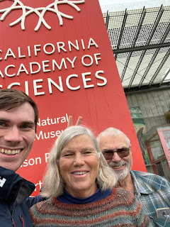 In front of the sign at the Academy.
 There were lots of interesting things to see inside, but this is the only picture I took.


 Ready to begin.


Back at Samuel P Taylor, though we were in the midst of winter, there are many signs of spring!


 A deer in campsite 15, right behind our campsite.


Sunrise at our Colfax property, January 2, 2024

Another view.
January 6, has become one of those historical dates we'll never forget, but it was a famous and important date long before 2021. It is the "12th Day of Christmas" and Epiphany, the day Christians celebrate the coming of the magi to Bethlehem. But it is also the birthday of two of our children, 3 years apart: Shawn born in 1976 and Erin born in 1979. We celebrated with Erin on Friday the 5th and Shawn on Saturday the 6th.

Grey Whale's Migrating hat I made for Erin from a pattern in my new pattern book.

Erin's birthday Baclava at the Mediterranean restaurant we ate at in Half Moon Bay

Erin getting ready to blow out her candle.
After lunch we went for a lovely walk on the beach at Half Moon Bay State Park.

A Great Blue Heron along the way.

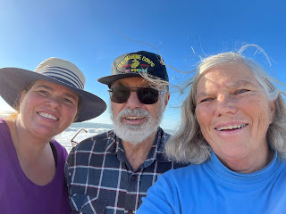
Erin, Rob and me with the Pacific waves behind us.

Meet Onyx, aka "Ony." pronounced Awnee.
A friend of Erin's was on vacation near Mount Shasta when this stray cat tried to adopt them. The cat was pretty scrawny, with matted and dirty hair, and folks assumed she was about 6 months old. Knowing that Erin was interested in getting a cat her friend offered to bring it to her after checking around for a possible owner. Ony arrived at Erin's home on her birthday, January 6. Turns out Ony does have a chip, but attempts to reach the registered owner in North Carolina failed due to disconnected phone numbers. She is actually a petite 3 1/2 year old, and she and Erin are in love!

Another picture of Ony
On Saturday, January 6, we headed over to Richmond to celebrate Shawn's birthday and the launching of his campaign for election to the Richmond City Council.

Granddaughter Sophia delivering the speech she wrote in support of her father.

Shawn blowing out the candles on his cake presented by his daughter Naomi.
Monday, January 8, was another good day for a hike so I continued on the Bay Area Ridge Trail to do the next section from our campsite to Brown Bridge on Sir Francis Drake Boulevard on the outskirts of Fairfax. Though a bit shorter than my first day hike (this one was 10.8 miles) it was definitely harder with over 1500 feet of elevation gain. This trail started on the Cross Marin Trail where our campsite is and then after a little over 2 miles of flat trail along Lagunitas Creek it started climbing up onto San Geronimo Ridge Fire Trail. Though fire trails are wider than single track trails, they are usually more challenging as they don't have switchbacks to lessen the steepness. There were some very steep hills, but all in all it was a beautiful hike, and I didn't encounter anyone else on the trail until about four miles from the end.The trail is obviously used primarily by mountain bikes, and some horses.

January 8, along the way on the Cross Marin Trail.
This sign, that is not completely accurate, is about a mile from our campsite.
Two years ago I worked with Ranger Nick Turner to recommend new trail signs throughout Samuel P Taylor State Park. We ordered about 50 new signs in March of 2022, and they have yet to arrive. Ranger Nick is hopeful they will get here soon so we can have a part in installing them in the correct locations.

Heading up the San Geronimo Ridge Trail.

A junction where I almost took the wrong fork.
There were three choices at this point, and the arrow pointing to the continuation of the Bay Area Ridge Trail pointed between two of the choices. Fortunately I had downloaded a map from the All Trails App on my phone and as I started down the wrong trail I referred to it and found out I was headed in the wrong direction. There is a subscription fee to be able to download maps on All Trails and I had resisted paying for it until this season. I have decided it is well worth the fee, especially since I hike alone most of the time. In addition to the map it tells me how fast I'm going, the elevation change, how many miles I've completed and how many I have left to go - pretty neat.

A banana slug on the trail.
Other wildlife I saw were 3 Salmon in Lagunitas Creek, birds and a couple of squirrels.

Looking north to Big Rock Ridge where I would hike a couple of weeks later.

And a view of Barnabe Peak to the north west.

A canyon view south east.

A Glimpse of Kent Lake.

Another view into a steep canyon.

Lots of trails intersecting with this one, but most were well marked.

The vegetation began to change as the soil became more serpentine.

Beautiful moss and lichen on a tree along the trail.

Another trail junction with low shrubs around.

Another view into West Marin, including Barnabe Peak on the left.

The road/trail ahead.

A pretty rocky section.
I'm glad it wasn't all like this!

Scenery opening up.

A view out to the Bay.

Finally a view of Mt. Tamalpais.

Back into forest as I skirt the edge of a Boy Scout Camp.
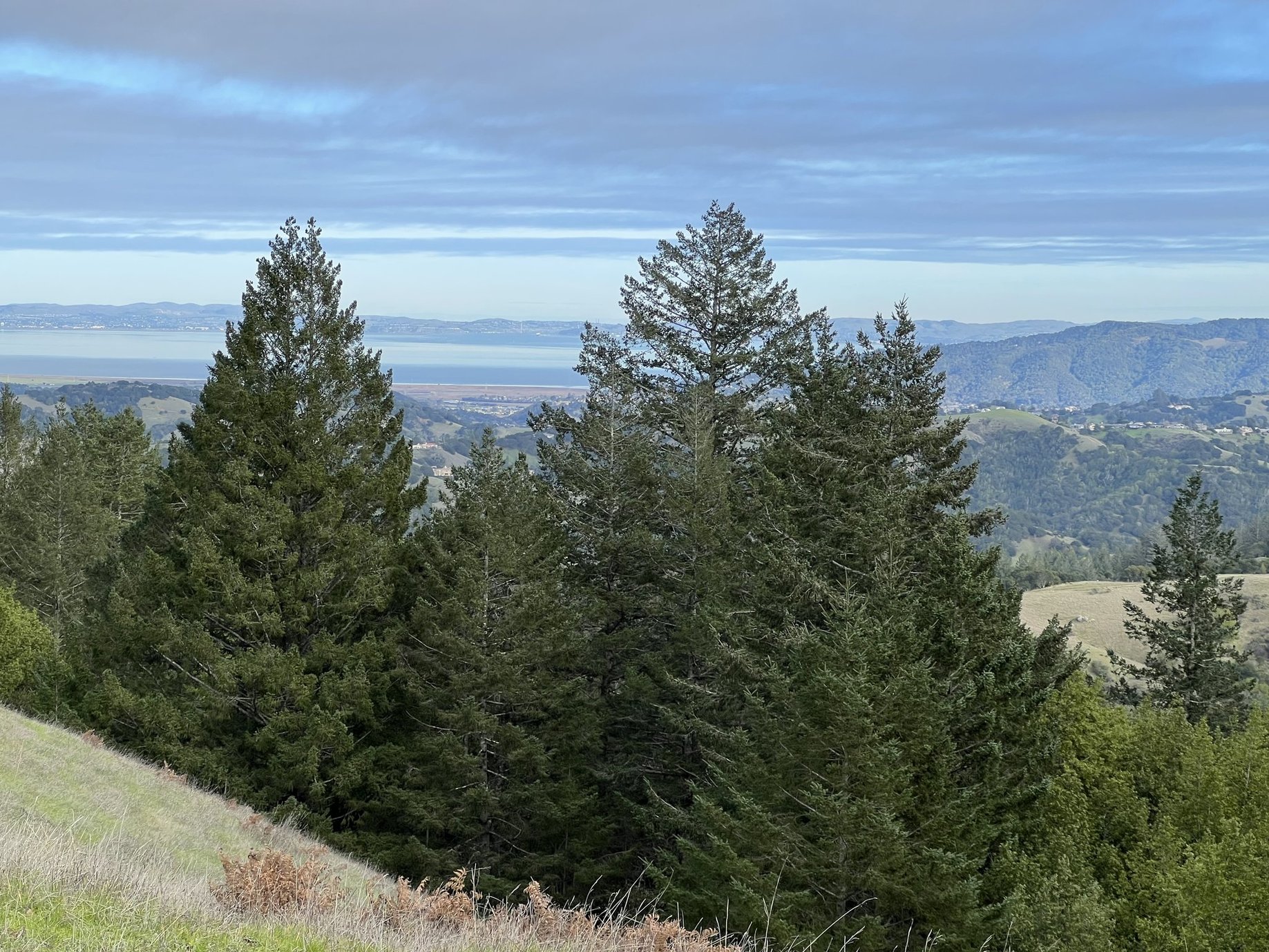
Another view of the Bay.

Mount Diablo in the background.

Near the end were switchbacks going down.
I much prefer switchbacks to straight up or down fire trails!

With the Bay and a pretty rock behind me.

Looking across to where the next hike will go.

A pretty bridge near the end.
There is Rob waiting for me in the car.

Looking back to where I ended the trail, and where I will begin the next.

A Christmas present puzzle completed.
A map and National Parks - two of my favorite puzzle subjects.
On Monday, January 15, I would continue on the Bay Area Ridge Trail where I left off the week before. This section was only 4 miles long, but rated as hard because of the steep elevation gain. It was another day of perfect hiking weather. Rob dropped me off on Sir Francis Drake Boulevard and then drove around to Big Rock on Lucas Valley Road to read a book while he waited for me to arrive.

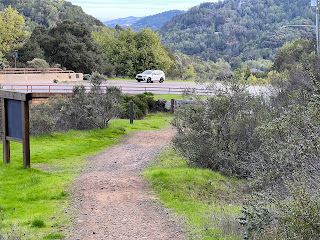
Going under Brown's Bridge at the start of my hike.
Lots of graffiti!

A map of the trail to welcome me.

Looking back to the bridge as I began to climb.

It will be a climb to the top.

Clouds covering the top of Mt. Tamalpais.

As I climbed higher I could look back to see San Francisco.

A wider view including the Bay Bridge.

The Richmond San Rafael Bridge.

Though most of the trail was through open grass land, there were some trees.

Finally the tip of Mt. Tamalpais is revealed.

Looking down the trail and across the Bay.

See the hikers on the ridge - still some climbing to do!

Another peak view of Mt. Tam.

Zoomed in on the peak view.

Zoomed in to look down to the bridge where I started.

Mt. Diablo on the left in the back.
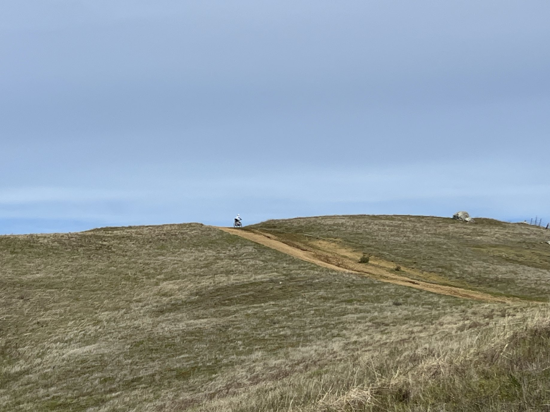
A bicycle up ahead on the top.

Looks like a drop off on the other side of the fence.

More of Mt. Tam revealed.
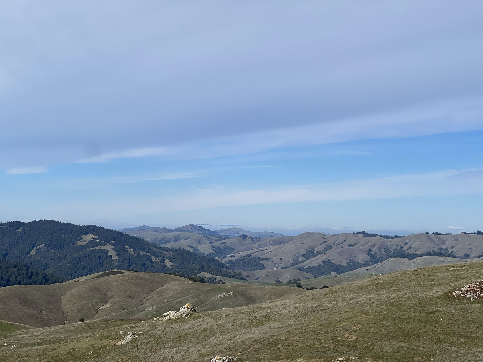
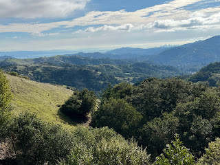
A View of beautiful West Marin from the top.

Zoomed in on Big Rock Ridge where the next trail section would take me.

A panorama view from the top.

Heading down the other side.
Hiking through Lucas Film lands, as in George Lucas.

Rob hiked up part way to meet me on the trail.

Skywalker Ranch: a workplace of George Lucas.

Our car waiting for us with Big Rock on the other side.
The end of one trail and the beginning of the next.
Our grandson Jacob invited us to join him at the California Academy of Science in Golden Gate Park in San Francisco on Tuesday, January 16. We had a good time exploring the Academy and going up in the observation tower at the de Young museum across the music concourse from the Academy.


This was one of hundreds of butterflies flying all around us in the Rain Forest exhibit.
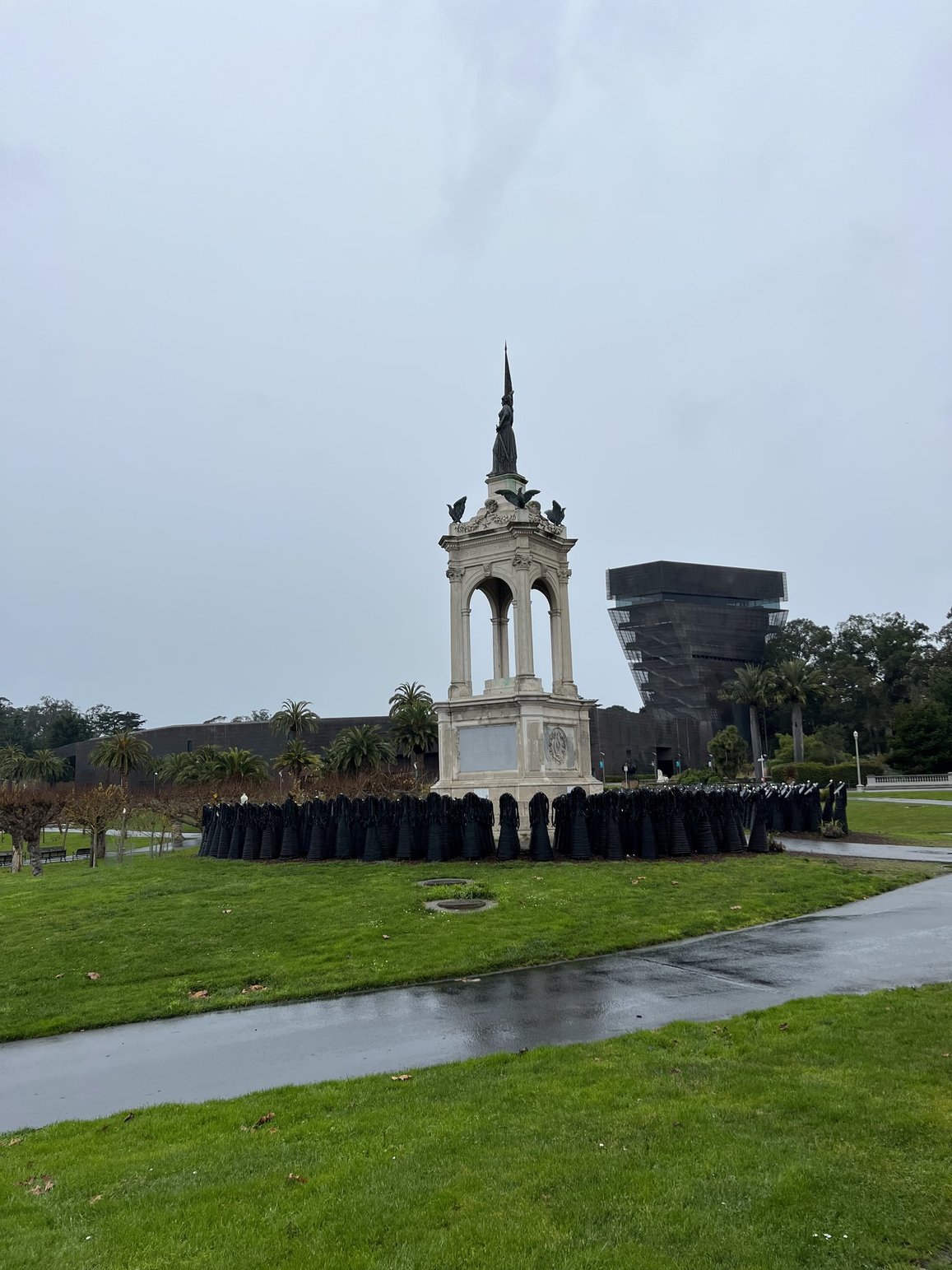
At the back of the music concourse between the Academy and the de Young Museum.
The empty space in this monument once held a statue of Francis Scott Key. On Juneteenth 2020 protestors toppled the statue of Francis Scott Key, author of The Star Spangled Banner, in protest of Key's history of slave ownership and continued support of the practice referring to Africans as "a distinct and inferior race of people." In the rarely sung third verse of The Star Spangled Banner, Key urged sending uprising slaves to their graves. On Juneteenth 2021, sculptor Dana King encircled Key's vacated spot with 350 sculptures, collectively referred to as "The Ancestors."

Here we are with the "Ancestors" and the music concourse behind us.
It was raining a bit, but we managed to avoid most of the showers while we were outside.

Another Christmas gift puzzle complete.
January 19 through 25 promised to be very busy days for me! Beginning with a quick trip to Eureka the 19th and 20th, football games in Roseville on Sunday, a Root Canal (my first) on Monday, celebration of Naomi's 8th birthday on Monday night and joining clergy colleagues in Livermore the 23 through the 25 for a "Gathering of Spiritual Leaders." Sunday and Monday Rob and I traveled together, but the rest of the time he did our camp duties at Camp Taylor while I was gone.
On Friday, January 19, I headed up to Eureka to be present for a preparation meeting on Saturday for a Cursillo Retreat weekend I will be working on in April. I was "begged" to join the team for this ecumenical retreat when the Protestant pastor who was originally scheduled to work on it had to back out at the last minute. It is good work, bringing Catholics and a variety of Protestant Christians together, and so I said yes. I took my time driving north, stopping for a lunch in Ukiah with my sister Elizabeth at the City of 10,000 Buddhas' wonderful vegetarian restaurant, taking a walk in Founder's Grove in Humboldt Redwoods State Park, arriving in time for dinner at Dolores (Rob's sister) and Jerome's home where I would spend the night. I headed back to Samuel P Taylor on Saturday afternoon so I would be back in time for us to leave Sunday to get to Ruth fiancé Jody's in Roseville to watch the final football playoff games. Thankfully the 49ers eked out a win, so we'll be heading back to Roseville for the Super Bowl!

Peacocks on the grounds of 10,000 Buddhas.

Jody's dogs relaxing during the game.

A Roseville sunset Ruth and I viewed when we went for a walk during half time.

Avi as a therian Sunday night in Colfax.
Avi taught me that a therian is a person who identifies as an animal.

What on earth am I doing standing on the kitchen counter!?!
In May 2022, our oldest daughter Sheila and I did an inn to inn hike in Sweden to celebrate her turning 50 and me 70 (but because of the pandemic we were 51 and 71 at the time of the hike.) Then in September 2023 our oldest son Scott and I did a canoe trip on the St. Croix River in Maine to celebrate his turning 50 earlier in the year. Our next child, Shawn doesn't turn 50 for two more years, but I figure I am aging faster than my children at this point, and the previous two adventures were so much fun that I will celebrate Shawn' half century early. Shawn and I will be heading into the Grand Canyon on a white water raft trip this May. In the preparation instructions for the trip it says one should be able to get on a kitchen counter and stand up without using a stool to get there, so I proved I could do it, and Ruth took a picture!

Sophia looking at Naomi's birthday Sundae, Monday, January 22.
Tuesday, January 23, feeling like I had the whole day free, I took another Bay Area Ridge Trail section hike, this one starting at Big Rock and going out and back to Big Rock Ridge. This would end a 55 mile contiguous section from the Golden Gate Bridge north. Because the trail has some sections yet to be completed there are breaks in the trail along the way. My enthusiasm for doing these section hikes may be waning as I have to drive further to get to the next sections, some of them quite short, and out and back hikes. I may concentrate closer to "home" and begin hiking more at Point Reyes Seashore, or other trails in the Golden Gate National Recreation Area. One day when I opened the All Trails App on my phone there was a message that said that there are over 500 trails nearby! Wow! Lots to choose from!


Heading up the trail.

Looking back at Skywalker Ranch.

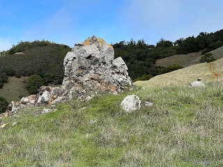
An interesting rock formation along the way.

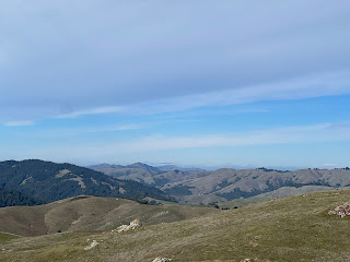
Heading up to the towers on the Ridge.

Richmond San Rafael Bridge from the top.

Looking down into Novato from the top.

On the way back down.

A pretty seasonal stream.
I think I really like seasonal water!

Looking back to where I was.

Back to the car at Big Rock after walking through a tunnel under the road.
Tuesday evening, January 23, I was sitting knitting in our motorhome when my phone rang. When I answered the caller asked if I was planning to arrive this evening. It took me a moment to register that it was the hotel I had a reservation for in Livermore to attend the Gathering of Spiritual Leaders. Whoops! I guess my past few days had been so busy that I totally forgot I had one more place to be! I threw some things together and hopped in the car and made it to Livermore in time to go to bed. I missed the first night's dinner and opening worship, but I enjoyed the next day and a half with colleagues. I was begrudging that this gathering was in the urban setting of Livermore rather than the beautiful natural spaces in the Santa Cruz Mountains and at Asilomar State Beach where it has been held in the past. I felt better about the location after going for a long walk on the second morning, on lovely paths and even through a park.

Water fountain on the side of a house in the Livermore neighborhood.

First time I've seen a pine tree with new growth coming out of the trunk like this.

What bird did I see in the tree?

Bridge over a creek in the park.
On Friday January 26, some bicycle riders coming by our campsite told us there was a Bay Laurel tree that had fallen across the Cross Marin Trail about a mile and a half west of us so we headed out to see if we could do anything to clear it. The tree was too big to remove, but with Rob's new Christmas present miniature chainsaw he was able to clear a tunnel to make it easier to get through.
Getting ready to clear a path.

The new tunnel.
On Monday, January 29, Rob and I headed to Point Reyes National Sea Shore for the first time this season. It was a beautiful, relatively warm day with little wind - a rarity at the Point Reyes Lighthouse, the windiest place on the west coast, where we were headed.

The Farallon Islands were clearly visible from Point Reyes.

Some wind carved rock above the lighthouse.

It's a long way down!
Rob waited up top while I went down.
The stairs have been closed every time we've been here before.

Beautiful water below me.

Beautiful coastline looking south.

The lighthouse.
A very important location because Point Reyes sticks out 10 miles from the main coastline.
I got to go inside for a tour with an Interpretive Ranger.

Looking up into the lens.

Inside view of the gears used for turning the light to create a unique signal.

The bronze door and plague on this "Fancy" light house mechanism.
I learned that this was made in France for the World's Fair in 1867, and was made "Fancy" to compete with other light house constructions.

311 steps back up.
Good training for the 7 1/2 miles, almost one mile up from the bottom of the Grand Canyon, that I will need to hike after our raft adventure. The hike up wasn't bad at all since I'm used to climbing steep hills.

Leaving the lighthouse to go back to the car.
Note the orange lichen (I think) on the rocks to the right.

Next stop was Drake's Beach to see the newly born Elephant seals.

A couple of moms looking like they are scolding each other.

What appeared to be an orphan baby seal looking of its mother.

The first Trillium I've seen, January 26.

Another one "unfurling."

And another one showing its pretty face.

Fetid Adder's Tongue.

Milk Maid
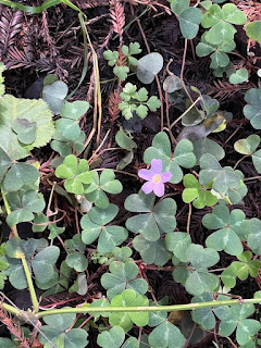
A Redwood Sorrel Blossom the way I usually see them.
They generally need sunlight on them to open, and we don't see the sun much.

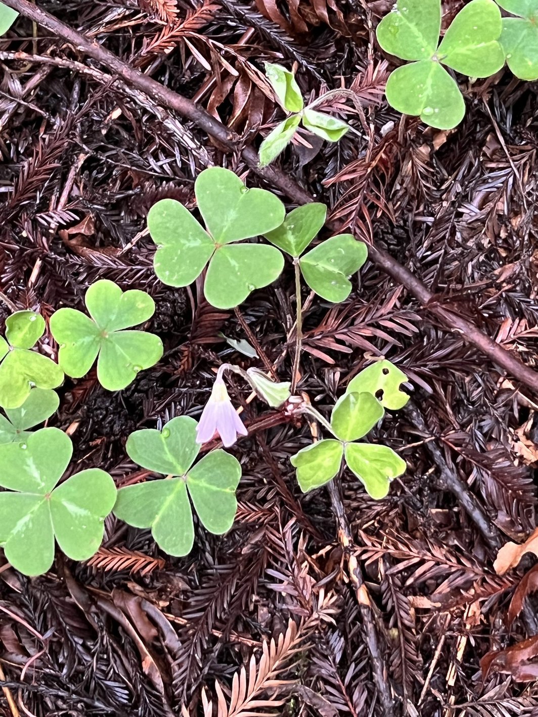
Redwood Sorrel Blossom wide open, but it was cloudy.

A patch of Redwood Sorrel.
LOTS OF MUSHROOMS!

I call these Shelf Mushrooms1

One up close.

A Waxy Red Cap (?) pushing up through the ground cover.

Blackfoot Polypore

Underside of the Blackfoot Polypore

Common Gilled Mushroom near our campsite.

Hairy Curtain Crust

I think these are Turkey Tail.

Turkey Tails

A wider view of the same.

More Turkey Tails.

And still more.

This one really looks like a turkey!

These looked like sea shells to me.

And these look like potato chips!

White Coral Fungi

Spindle Fungi

Mushrooms aren't the only interesting flora.
Moss patterns on the fence.

Deer are a rare site in the campground.

Wild Cat Canyon Creek Falls, January 14

Same spot on January 30.
LOTS more water to come on February 1!

"The Prettiest Water Fall" at Samuel P Taylor, January 21.
I need to come up with a name for this seasonal sight.

A beautiful reflecting puddle in the picnic area.

Elsie hanging out by Ruth as she sips her morning tea.

And here she is looking tucked in with one of Avi's treasures.


Comments
Post a Comment