Another Adventure of a Lifetime!
We made it!
Me and son Shawn after hiking up the Bright Angel Trail.
Tuesday, May 7, Rob took me and Shawn to the Sacramento airport to begin our 6 day adventure in the Grand Canyon. This is the third of 5 "Adventures of a Lifetime" to celebrate each of my children turning 50. The first of these adventures came a year late, due to COVID, for daughter Sheila and me celebrating our 50th and 70th birthdays when we hiked from inn to inn in southern Sweden in the spring of 2022. Son Scott turned 50 in February 2023, and he and I did a canoe trip down the St. Croix River during Hurricane Lee in the fall of 2023. These trips were so fun and such a great opportunity to spend individual time with my children that I didn't want to wait two more years for Shawn to turn 50 so I decided that since I'm aging faster than they are I would celebrate the next three children turning 50 early. Friends Bill and Barb in Eureka had raved about their trips down the Colorado River in the Grand Canyon and said it was something I didn't want to miss. Shawn was very happy with that suggestion so I got on a waiting list for May, September or October. This was a six day river trip, including hiking to the top of the Grand Canyon at the end of our time rafting. I definitely didn't want to do that hike in the summer heat! In January the rafting company, AZRA, called to say two spots had come open in May and so Shawn and I cleared our calendars to make it happen.
Shawn is experienced with white water in a kayak, but my only experience with it was riding an inner tube down the relatively placid and shallow Bear River, and my canoe adventure in Maine. I admit I was a little intimidated by videos of white water on the Colorado River. I took the description of the hike out (4,600 foot gain in elevation over about 8 miles of trail) seriously, but hiking is something I do regularly. The first rapids we went through were a little scary, but after a couple of days I enjoyed them more than worried about them. By the fourth day when the temperatures in the canyon had risen I wasn't even that worried about being thrown out of a raft. Fortunately we all stayed put in the rafts and made it safely to the bottom of Bright Angel Trail. The river and canyon were beautiful, the river guides were exemplary in every way, we enjoyed the company of the other guests (21 guests and 8 guides), and had a wonderful mother son adventure. The hike out was hard and hot, but not any harder than I'd thought it would be, and the temperature only got into the low 80s. Thank you Bill and Barb for encouraging me to make this journey!
Me and Shawn at the airport ready to begin.
Mono Lake from the plane.
Arriving at the Flagstaff airport - reminds me of the small airport in Arcada, California.
In our hotel room after orientation on Tuesday night, May 7.
Our stuff had to be sorted three ways: Things to be left to claim after the Canyon trip, Things that we might need while on the river, and things we would need once in camp each night. Everything we took on the rafts with us would have to be carried out on our backs when we reached the Bright Angel Trail.
Our bags are packed and we're ready to go.
White bags are "carry on" to be kept close while on the rafts.
Blue bags are for overnight in the campsites.
To the left are our backpacks to be used to hike out with later.
A view of the San Francisco peaks from our Flagstaff hotel.
The Grand Canyon is on the other side of these mountains.
On board the bus headed to Lee's Ferry where we would board the rafts.
Wednesday, May 8, 2024
A bus rest stop at Cameron.
The old and new Navajo Bridges where we stopped to walk across and visit the visitor center.
Rob and I walked across the old bridge in 2020 on our first cross country trip.
In 2020 we saw California Condors perched on one of the bridges, but not this time.
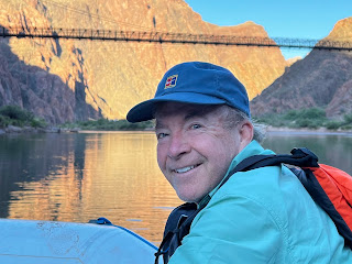
Shawn and be on the Bridge with the Colorado River below.
Navaho Bridge Visitor Center.
AZRA's school bus that transported us.
Robby, the leader of our raft adventure, who came aboard to greet us as we arrived at Lee's Ferry.
Our six boats lined up and ready for us to board.
There were 3 oar boats to carry guests, one oar supply boat, one paddle boat and one wooden dory.
Shawn and I were grateful to get to ride in all 5 boats that accommodated guests.
Robby demonstrating the correct way to wear the life vests.
On board and ready to go down the river.
Sara, our first river guide.
All of our guides were extremely competent, personable and strong!
The dory with Robby on the oars.
We're on our way!
Crossing under the Navajo Bridges.
Down river from the bridges.
One of several Big Horn Sheep we saw at the bottom of the canyon.
A typical view from the raft.
The first day was a short trip, about 11 miles, with no serious white water.
Arrived at Campsite 1 at Soap Creek.
We are getting instructions for how to use the latrine.
Liquid waste goes in the river, solids are carried out on the rafts.
All of our campsites were pristine when we arrived and when we left them.
A view from the Soap Creek campsite.
Beautiful, but deadly Thorn Apple along the trail.
We saw many of these beautiful white flowers that are open at night, close when the sun hits.
Found some water, and pollywogs, in Salt Creek wash.
The flowering bush is Tamarisk.
Continuing up the trail.
Beavertail Cactus, a variety of Prickly Pear.
On Phil's boat the second day.
Phil was quite a character, and I don't know if Shawn's offering him $5.00 for a fun ride had any influence, but we definitely had a fun ride through some white water, getting drenched more than once.!
See the drift wood on top of the large rock?
That's been there a long time, since the river ran high and wild in 1957.
One of many impressive views along the way.
Shawn who managed to video most of our passages through the rapids.
Gathered around in camp, night 2 near Silver Grotto, Mile 29.
With the river and Canyon walls behind us.
Looking at our camp site.
Early morning light hitting the high parts, May 10.
A little later in the morning.
Back on the water, Day 2, this time in the Dory.
There were five boats with five different guides that carried guests. We managed to ride on each of the boats and got to experience the five different, but all wonderful guides.
A morning stop on day 3 to hike up to some Petroglyphs.
Allionia incarnata - one of many pretty desert blooms.
Apricot Mallow
There are ancient petroglyphs on this rock.
And on this one.
Hiking back down to the boats.
Interesting formation in the rock.
A cave in the rock.
Waterfall coming out of the rock.
Robby, our Dory captain, and leader of the whole trip.
Redwall Cavern about mile 33.
From the river it didn't look like much.
Here is the view from inside this impressive cavern, looking out.
Shawn practicing climbing on the back ceiling of the cavern.
Springs coming out of the rock across from the cavern.
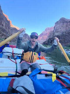
Robby let Shawn take the oars for a bit, even navigating some white water.
Shawn is standing in front of an exploration tunnel above where we stopped for lunch.
This tunnel was part of plans for one of two dams planned to be built in the Grand Canyon.
Fortunately because of the efforts of many to resist dams being built in the Grand Canyon the exploration tunnel is the extent of evidence of those planned dams.
Shawn's picture from inside the tunnel.
Writing on the wall inside.
Back on the river.
Springs coming out of the canyon walls.
More interesting canyon walls.
We were all surprised by these deer along the shore.
No easy access to the rim here!
View over our tent, Campsite # 3 at 50 Mile Camp.
Rock climbers headed up out of 50 Mile Camp.
I walked to the base of where the rock climbers began.
Looking back at the area the climbers went up.
Shawn's picture of climbers below him.
Shawn at the top.
Shawn is an experienced climber, so this was an easy feat for him, but he assured me after the climb that it was no place I wanted to be! I didn't regret not going at all. There were plenty of interesting things down below.
Like this Prickly Pear Cactus in bloom.
Looking like rain is coming our way, early morning May 11.
We did put the rain fly up on the tent the night before, and it did sprinkle a very little bit. We really didn't need the rain fly since the rain was so light and the desert air so dry that even if we had gotten wet we would have dried rapidly.
Boats ready for day 4 on the river.
Look at the track this little "rolly polly" made in the sand.
We saw lots of interesting tracks in the sand - most of which we couldn't definitively identify.
A California Condor!
Soaring high above us.
Back on the river, Day 4.
This time in the paddle boat with Amber as our guide.
The confluence with the Little Colorado River.
This beautiful color is from dissolved calcium carbonate in the water.
We were blessed by very clear water in the Colorado River and getting to see the incredible turquoise blue of the Little Colorado. Later during Monsoon season both rivers will run full of sediment and we learned that the Little Colorado is often deep red with sediment during the heavy rains.
An interesting looking rock formation.
I sat down under this to enjoy the solitude of the Little Colorado River.
Here I am under cover from the sun.
An indescribable scene!
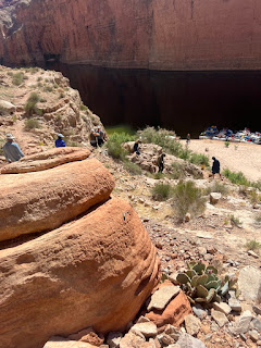
The fourth night, May 11, we camped at Carbon Creek. Shortly after camp set up a hike up to a slot canyon was announced. We were told to wear closed toed shoes and to carry water on our backs so we would be hands free for a "little easy climbing." When I asked how difficult the climbing would be I was told it was about the same when we had hiked up to the petroglyphs on Day 3, so I joined the others. 3 guests chose to stay in camp. The first half mile of the hike was totally doable for me, but then we came to a formidable wall, and though Shawn and the guides assured me they could get me up it, as I tried the first big step I was afraid of how far I had to reach, and more afraid of coming down it again. I chose to recognize my limits and let the others go on. I admit I was disappointed in myself and moped a bit at first after the others left, but realized I had made the right decision for me. And I got some treasured solitude to watch a lizard and see some things at a slower pace as I returned to camp.
The wall that stopped me.
Hard to see it's perspective without people on it.
Here is the picture Shawn took of folks climbing down.
Here is the lizard that visited me as I sat on a rock before heading back to camp.
Interesting water carved holes in a rock on the trail back to camp.
Back in camp.
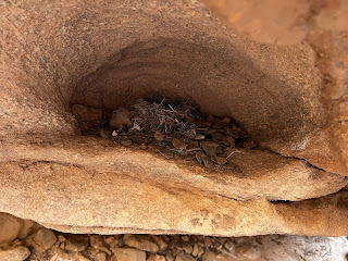
Shawn saw what looked like an empty bird nest up in the slot canyon.
It wasn't empty, but there were no birds to be seen.
Morning, Day 5, March 12.
A view down river from Carbon Creek campsite.
A closer up morning view downriver.
Tyler, our river guide for day 5.
A view of the paddle boat that we rode the day before.
Watching the Dory go first down the rapids.
A stop along the way to explore an archeological site.
We were told this was probably a trading location for indigenous people long ago.
A Hedgehog Cactus in bloom.
Shawn looking at something interesting at the site.
Me with the river behind.
Both of us at the site.
pieces of old pottery.
Back on the boat.
Our lunch stop, Day 5, 75 Mile Creek.
Before lunch we hiked up the dry creek bed.
Interesting wall in the little canyon.
More interesting wall.
Where the gravel bottom ended and the rock bottom began.
Here, and at the Little Colorado, the guides lead us about a half mile "upstream." and then stopped to wait for us to explore, cautioning us to not get too far away. At both places I walked a little further than anyone else, and had a special time of solitude in the vast beauty and wonder of the place.
Back on the water after lunch.
Looking down river after having gone through some white water.
The rock keeps changing as we go deeper and deeper into the canyon.
And further back in time.
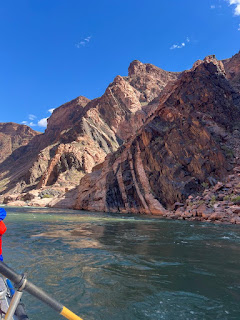
The striations in this rock are evidence of the uplift that helped form this place.
3:30 in the afternoon, May 12.
Last night on the river at Cremation Campground.
We were told there is no escaping the sun here, but there was a good cloud cover.
Shawn slept outside on our last night, and I slept in the tent with the door open to the sky.
After falling into the boat on the last morning.
I had little trouble getting into and out of the boats, except on this morning.
We got to paddle in the paddle boast for our last 1/2 hour on the river before the big hike out.
7 of the 8 guests we left behind.
The entire trip is 14 days long. Some folks choose to do the whole 14 days, but some like us chose the upper canyon for six days which meant we had to hike up Bright Angel Trail to the south rim of the Grand Canyon. And others chose to do the bottom 8 days and had to hike down Bright Angel Trail to the river. There were 13 of us who would hike out and 10 hiking in.
Signs of civilization and the first bridge since Navajo Bridges over 8 miles upstream.
Amber, our paddle boat guide is behind us.
Rosie and Paul from the UK
All of the folks we met on the trip were wonderful, and we connected with all, but Rosie and Paul were particularly significant. We met them at the airport as we were waiting for our hotel shuttle. Rosie is originally from Scotland and Paul from England, and they now live in Wales. This was their third trip down the Colorado River in the Grand Canyon. They did this same upper canyon trip 20 years ago and after they reached the top of the trail they vowed they would come back every decade while they are alive. Their second trip was of the bottom section where they hiked down. They said the first trip was life changing. When I quizzed them about how it was life changing they both mentioned "insignificant." Paul said the vastness and wonder and beauty of the canyon made him feel insignificant, and Rosie said it made everything "out there" seem insignificant.
Neil from Alexandria, Virginia, was another special person on the trip.
He is an avid hiker, but had not camped since he was a kid.
Getting ready to take off our life jackets and give them back.
Notice that Shawn's says Humpback Chub.
Humpback Chub is a fish native to the Colorado River.
Each jacket has a unique name that relates to the canyon in some way.
Mine is Tamarisk, a flowering shrub.
Tamarisk is an invasive bush that grows in the canyon.
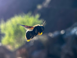
A bumble bee that Shawn took this picture of.
It seemed attracted to our blue shirts.
And so it begins!
The hike up to the top would be close to 8 miles, and 4,600 feet gain in elevation.
One of the many switchbacks.
We have a long way to go to the top.
But looking down we can see how far we've come.
They are called Century Plants because they were believed to bloom once every 100 years and then die, but something I read said that closer to Lee's Ferry they take about 10 years to bloom, but the further down the canyon they are they take longer.
Though the hike was long and hot, it was beautiful!
And though it felt hot to us, it was mild compared to what it could be. The high temperature on our hike out was in the low 80s. Later in the season the temperature gets well over 100! I don't think I could have done it at the high temperatures - that's why I chose May and not July to do the trip.
We still have a long way to go to the top.
Three mile house.
A shady spot to pause, with a latrine nearby.
This was three miles from the rim so we had already hiked almost 5 miles. It took me about 4 hours to get here, but the next three miles would be steeper and take me about the same amount of time.
Looking back down after three mile house.
Shawn pointing to fossils in a rock that had split in a rock slide.
And there are pictographs, painted eons ago.
Pictographs are paintings on the rock, petroglyphs are scratched or carved into the rock.
It was delivered by helicopter to work on the multi-million dollar water project to improve the delivery of water from the north rim to the south rim. There was piped water available at Havasupai Gardens, maybe three miles from the river. That was where we met our guide Helen and those coming in for the lower portion of the raft trip. River guides had hiked with us to that point and then Helen would hike up with us to the rim. She told us that the National Park Service now requires the raft companies to provide guides for the river guests. In the past they didn't and many people got in trouble hiking out and hiking in. When the water project is finished there will once again be piped water at 3 mile house and at a similar shelter at 1 1/2 miles from the top, but we could not refill water after Havasupai Gardens.
Me hiking up the trail through the only tunnel we went through.
A mule trail coming down.
These mules were carrying dirt to assist in trail maintenance.
Here we are with guide Helen.
This was her third trip down and up this week.
I had hoped not to be the slowest hiker in the group, but alas I was. There was however a wonderful advantage to being last as we got to hike with Helen, hear lots of stories about the canyon, and she pointed out things to us like the fossils and pictographs that others passed without noticing.
As we approached the top I thought I didn't want to turn on my phone that had been off all week. Being disconnected was definitely a gift of this trip! I did of course turn it on, called Rob to let him know we were safely out of the canyon and began to delete the hundreds of junk emails that had accumulated. Walking into our lodge to check in felt weird and uncomfortable. We had not been in a building for 6 days and the closed in building was stuffy feeling. After a shower I joined Shawn and some of the other hikers for a cold drink before finding some dinner. We spent the night at Maswik Lodge on the South Rim of the Grand Canyon before getting a shuttle to the airport in Flagstaff the next day. Because our flight wasn't until evening we were able to walk around the rim a bit, have breakfast with some of our friends, and visit the visitor center before a 3:00 PM shuttle.
Sunrise time over the Grand Canyon the day after.
The sun is now appearing, and a day begins anew!
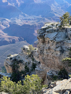
A pretty view from the top.
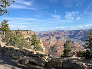
And another!
Pistachio Waffle.
The breakfast special at the El Tofar Lodge restaurant.
The waffle tasted good, but I should have chosen a breakfast with more protein.
The "trophy room" at the El Tovar.
Where did the Moose come from?
Remembering our hike out the day before.
And another view with the canyon behind.
More dramatic scenery.
I had seen the canyon from the top three times previously, but seeing it from the top after riding down the river and then hiking out was a very different perspective.
An Elk resting near the canyon Rim Trail.
A little puzzle of the Grand Canyon - one of my souvenirs.
Elsie was much happier playing with Ruth in Colfax than she would have been in the Grand Canyon!
















Comments
Post a Comment