Our Tahoe Summer Comes to an End.
 |
| A momma bear with her two cubs. This family was seen several times around our campground late in the season. |

See the moon over "my" mountain?
Wednesday morning, July 24, 2024.

Thursday morning, July 25.
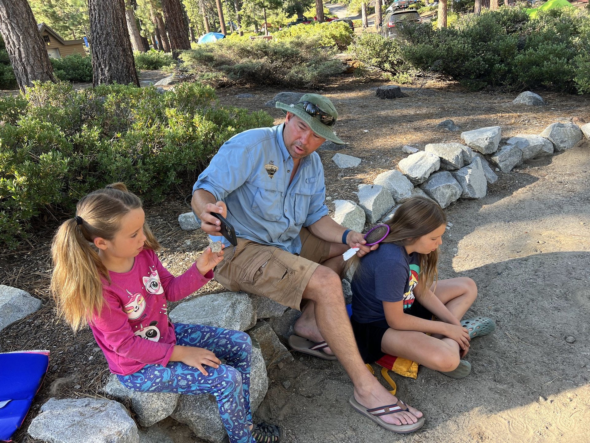
Son Shawn and granddaughters Naomi and Sophia came to spend some time at Tahoe with us.

This is what Shawn was taking a picture of.

An injured butterfly rescued by Naomi.

Beach fun!

One of the several Crawdads Shawn and the girls caught and released.

Sophia eating the "whole thing" at Camp Richardson's Ice Cream Parlor.

My vintage (63 year old) Girl Scout Pocket knife soaking in vinegar.
Supposedly soaking in vinegar is a good way to clean an old pocket knife - NOT - I found out that the vinegar eats the metal away too so now my old pocket knife is pitted.

Sunday morning, July 28.
Interesting clouds over South Lake Tahoe.

Sun coming up, July 29.

A Bear butt, evening July 29.
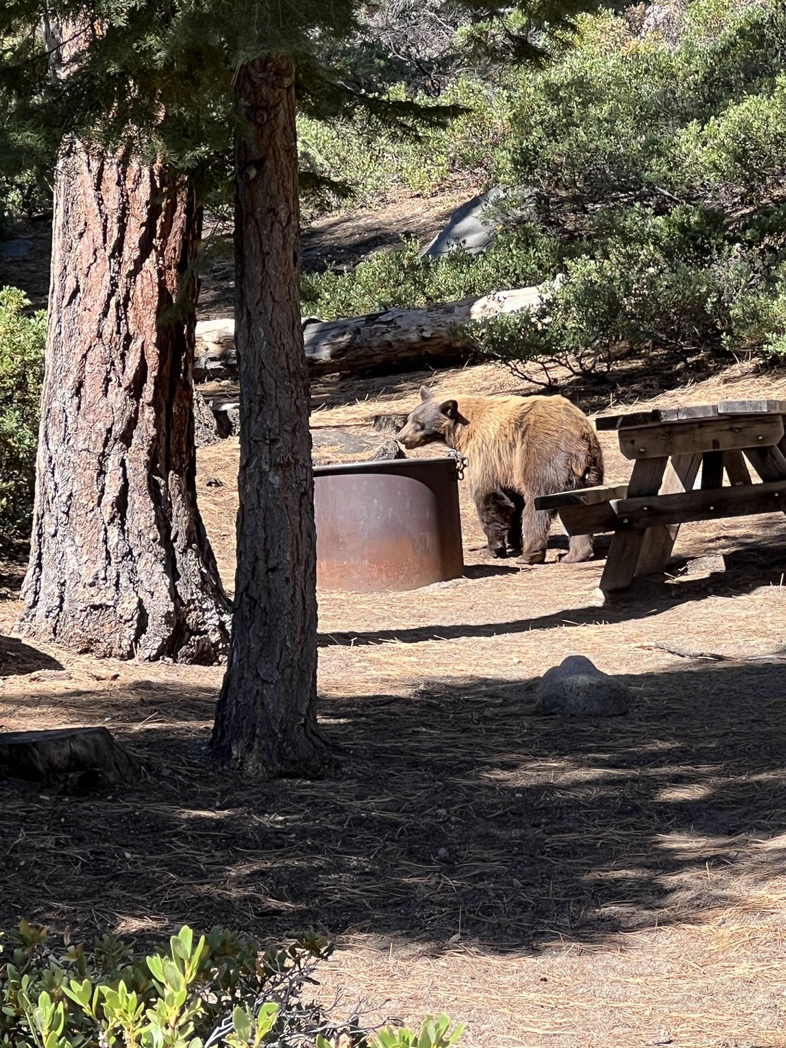
We have seen so many different bears this season, but have only gotten pictures of a few. Most of the time when we see the bears we are trying to encourage them to leave campsites or encouraging campers to manage their food better so I'm not always able to get a picture.

Sign at boat camp, about the half way point on the Rubicon Trail.
Tuesday, July 30, Lisa, the other camp host, and I decided to "cheat" and drive to boat camp so we could hike the other end of the Rubicon Trail. I have hiked the entire 7 mile trail from Eagle Point Campground to Calawee Cove at D.L. Bliss State Park and back in the past, but because D.L. Bliss is currently closed Lisa and I were reluctant to hike the whole 14 miles round trip this year since we couldn't call Rob to pick us up if we didn't feel like hiking back.

The trail has many spectacular views of the bay and Lake Tahoe.

Some of the wonderful rocks along the way.

The Rubicon Lighthouse is at the bottom of those stairs.

The unimpressive light house - looks like an outhouse!
This lighthouse's claim to fame is that it was the highest elevation lighthouse on a navigable body of water in the entire world! It operated from 1919 to 1921.

A squirrel begging for a snack from Lisa and me at Calawee Cove.

Neither the squirrel nor this Blue Jay were successful in getting any treats from us.

And now to head back to Boat Camp.

Lisa and me at Rubicon Point with the chain holding us from falling off the trail barely visible.

Oh the colors of the water!

Looking south across the lake.

More of the rock formations.

Pretty Gentian on our hike.
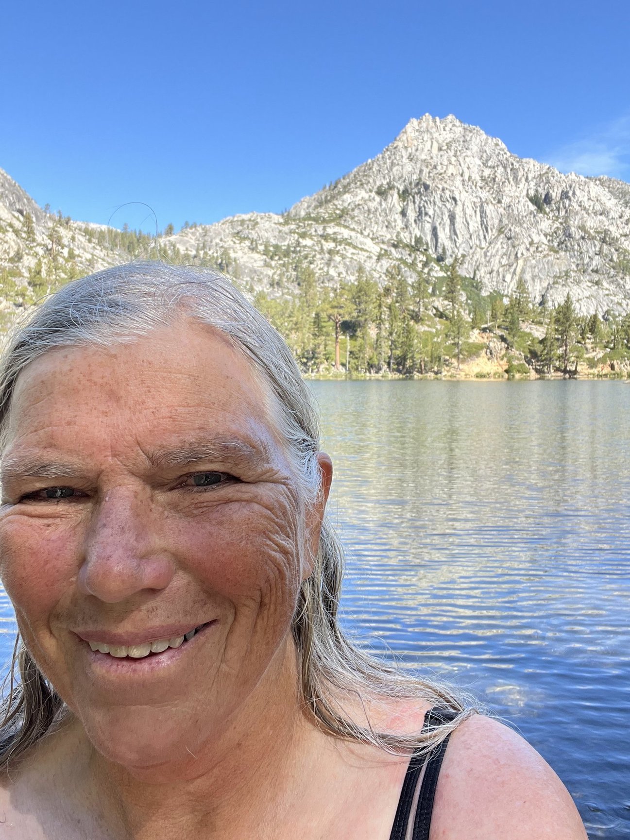
On August 1, another Lisa and I would hike at Mt. Judah starting at Donner Summit on old Hwy 40. Lisa has been a friend since my days in Kings Beach. I was happy to have her suggest the Mt. Judah Loop Trail - a trail I've hiked many times, but not for over 12 years. I think the first time I hiked it was with my sister Theresa, but I've also hiked it with Rob and even with my sixth grade students when I was a teacher in the 1990s. It has beautiful vistas and evidence of the the history of wagons crossing the Sierras. Lisa told me to bring my swimsuit for a dip in Donner Lake after the hike. I thoroughly enjoyed the refreshing swim and was embarrassed to acknowledge how infrequently I've been swimming. Lisa reminded me of the many times I went in the water on our around the lake Kayak trips almost 20 years ago. Her reminder prompted me to begin swimming daily at Eagle Point and then to set a goal of swimming in 75 different bodies of water before my 75th birthday in November, 2025. I have since revised it to 75 different swimming holes because I think that's doable, but not positive about 75 different bodies of water - 15 months to complete the goal! Swimming hole #1 was Donner Lake, and #2 was Eagle Point Campground beach where I swam almost daily for the the rest of our season.

Part of the trail is on the PCT.
The first time I hiked here there was no Mt. Judah Loop. When Sugar Bowl Ski Resort added a ski run crossing the PCT they were required to make a route around the chair lift.

Me and Lisa just below Donner Peak before going up on Mt. Judah.

Marking the Emigrant Trail - Truckee Route, Coldstream Pass.
7,850 ft. - Highest point on the Truckee Route.
The Donner Pass is somewhat north of this one and lower in elevation.

This one marks Roller Pass where the emigrants devised log rollers to move the wagons over this pass.
This marker was after we hiked over Mt. Judah.

A view of smoky skies over Donner Lake from Mt. Judah.

The moss grows thick above the winter snow line.
On our way down looking across to Castle Peak.

Back at Eagle Point Campground, August 2.
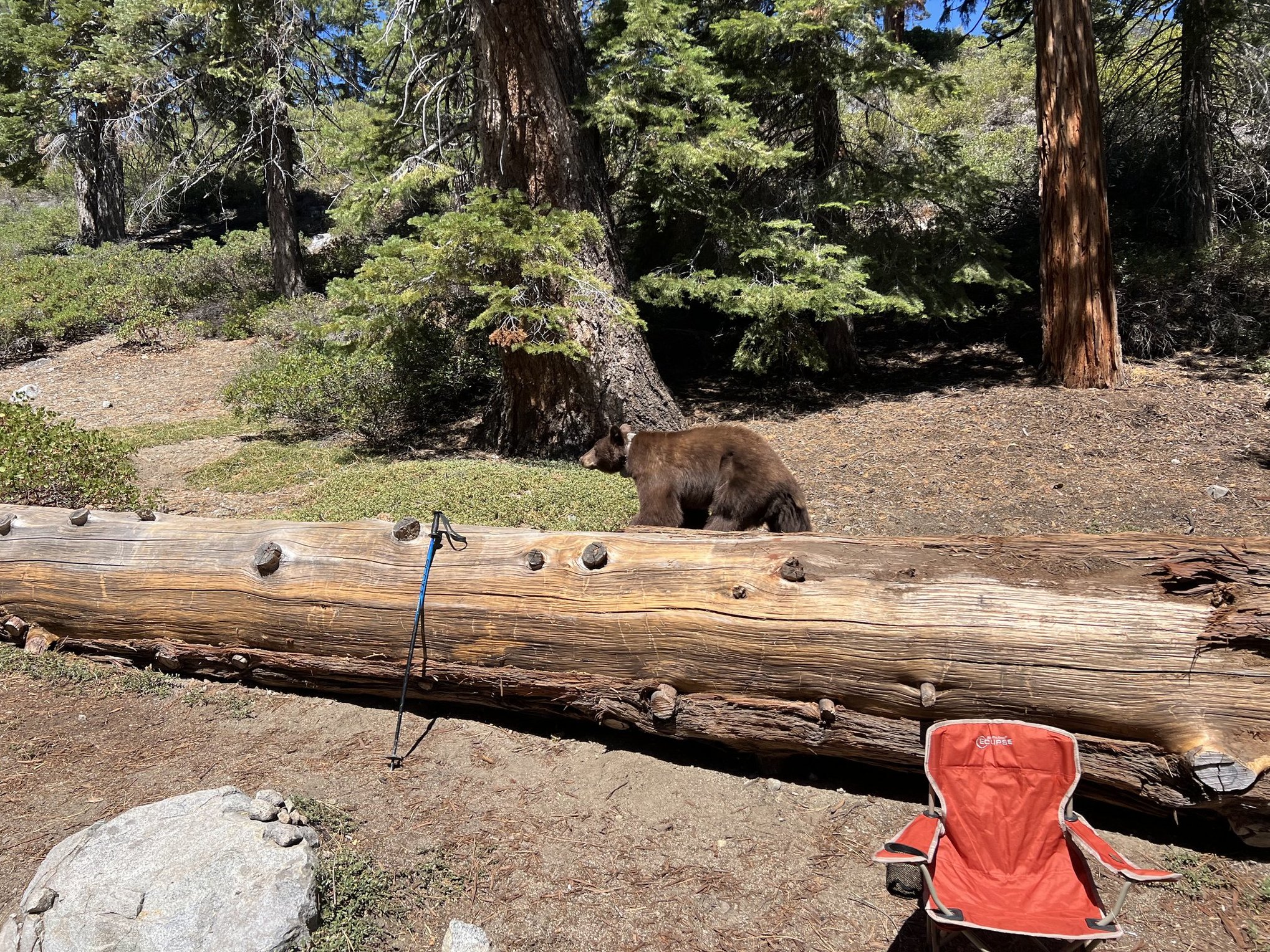
This is a young bear, probably about 18 months old and newly weaned.

Another bear on August 4.
We were in Colfax overnight August 5-6, for an appointment for our car in Auburn. I drove about two miles from our house on Tuesday morning, August 6, to park where I could easily access the wonderful trails of Weimar Institute. My goal was to hike the entire Frontier Trail, about 3 1/2 miles I think, but I missed a turn somewhere and my short hike turned into over 5 miles and included a little bewilderment!

The bridge I crossed over the Boardman Canal to get out to a road.
Can you see all the bones on the bridge?
Kind of weird! and I wasn't too confident in the bridge's stability as I crossed.

The road back to the main grounds of the Weimar Institute.

Looking down at the freeway and the sign that says Weimar.

Back on the Institute Grounds.
Next time I'll go the other way around on the Frontier Trail and see where I missed the turn.
Every year at Tahoe we see a yellow hot air balloon on many mornings being launched off a barge at the south end of the lake. I didn't see them as often this year as in the past, and I'm not sure why. Perhaps the wind conditions weren't right, or perhaps they raised the passenger fare beyond what folks want to pay. 3 years ago I was told it cost $350 per person to go for a ride. I also didn't see many, if any, come over Eagle Point and over Emerald Bay like I have in the past. I'm sure that was because of wind direction. One early morning I was sitting outside by our RV when I heard what I at first thought was an RV generator operating before the allowed time, but then I recognized the noise as that made by the hot air balloon's fiery thrusters, and I heard people talking. When I looked up the balloon was right above our campsite - a first.

The balloon above us.

A close up shot.

Looking across our RV the same morning.
My sister Theresa arrived at Lake Tahoe on July 31, to begin her August and September shift as a camp host at Sugar Pine Point State Park, just 20 minutes north of us. On Thursday August 8 daughter Erin was visiting and so we arranged to meet Theresa and her dog Pippin at the Taylor Creek Visitor Center, a favorite spot for all of us. When we arrived there were lots of folks sitting around waiting for something which we learned was the impending arrival of Smokey Bear as it was Smokey's 80th birthday!

Rob and me with Smokey.

Theresa and Pippin with Smokey.
Erin declined to have her picture taken with Smokey, but she and Rob and I played miniature golf in South Lake Tahoe while she was visiting. Erin beat us both.

A mushroom on the Rainbow Trail at Taylor Creek.

Air Quality map on Thursday evening, August 8.
We were afraid the smoky season was beginning, but this was really our only bad air quality day of the whole summer. There have been several fires that could have blown smoke into the Lake Tahoe Basin, but we were selfishly grateful that the prevailing winds protected us.

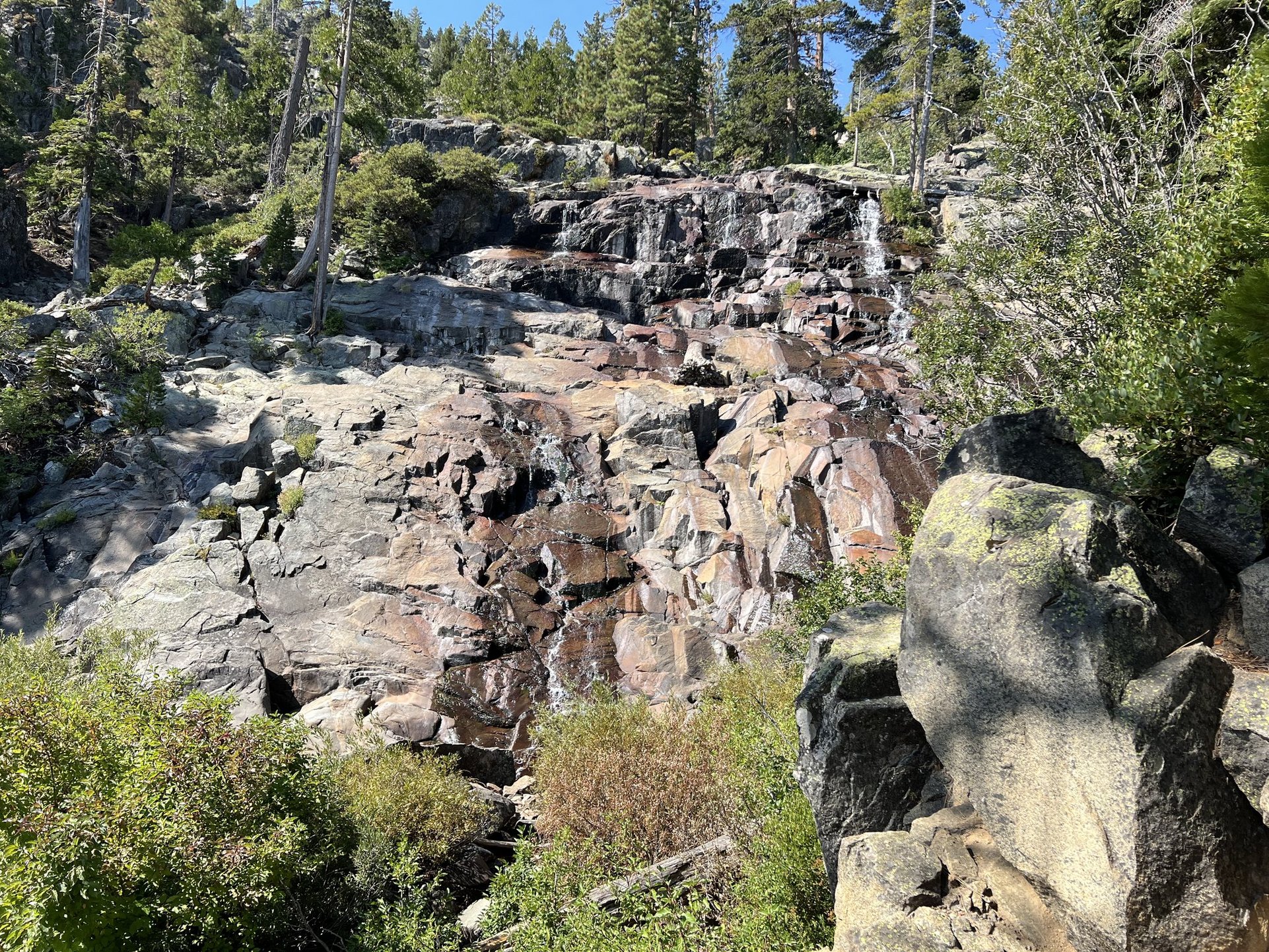
Saturday, August 10, I hiked to Lower Eagle Falls between morning and noon camp checks
The falls were quite diminished from June! Not much snow left up in the high country to melt.

Looks like a highway, doesn't it?
Actually this is part of the miles and miles of bicycle and walking paths in Roseville near where Ruth is now living with Jody. Rob and I spent the night with them on Sunday, August 11, and I went for an early morning walk on Monday morning. It was going to be a hot day, but the early morning was very pleasant.

Monday evening sky, August 12, at our Colfax property.

Early morning, August 15 at the Eagle Point Overlook.
One of my favorite things is to watch the evidence of the rising sun as it lights up the tops of the mountains before you can actually see the sun coming up over the mountains to the east.

That's an Osprey nest up there.

And that's an Osprey in the nest!

Beautiful Emerald Bay and mountains, late morning, Friday, August 16.

And just a few minutes later we saw this fellow - same one I think as two weeks earlier.

Here it is coming down a tree - pretty cute.
Saturday, August 17, I needed to drive to Auburn in a loaner car to retrieve our car that had been in the shop for repairs. On the way I stopped near the Eagle Falls Trailhead so I could hike up to Eagle Lake for a swim. This was of course a much shorter route than the round trip one I like to take from our campsite - 2 miles total versus almost 10. This time I remembered to take more pictures of some of the stairs - there are lots of them! But they are certainly more doable without the camping back pack that I carried on my first trips up and down this route beginning when I was 13.

Some stairs.

A view of the barely trickling Upper Eagle Falls.

These are the most evenly placed stairs, but my least favorite.
Because they are so even you just keep going, no pauses to find right footing.
And there is a steep drop off right next to them.
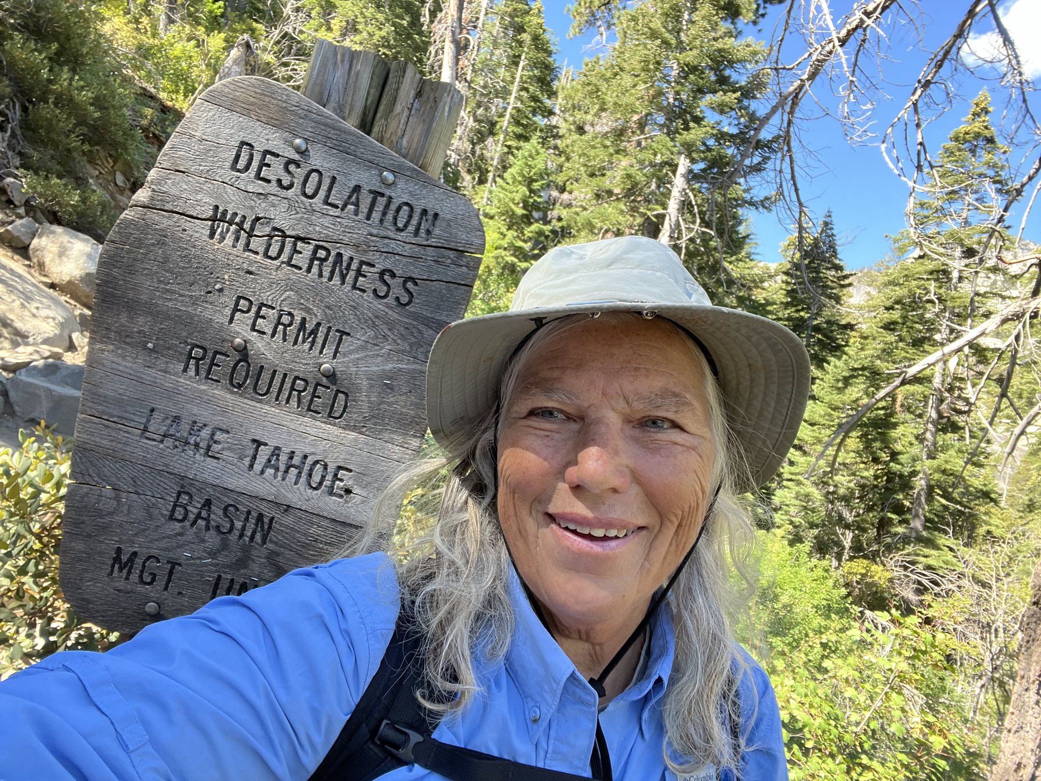
Entrance to Desolation Wilderness.
One of the most beautiful areas in the entire world!

A view of my mountain on the way up.

A view looking back at Emerald Bay and Lake Tahoe.

More stairs.

Beautiful Eagle Lake!

Swimming hole #3.
I had a truly glorious swim!

My mountain from the swimming hole.

Back at Eagle Point Campground's Overlook.
Tuesday morning, August 20, with the lingering full moon.
Just below the moon is Eagle Lake nestled in the granite mountains.

Zoomed in view of the moon.
Oh, look! Another bear!
August 21.
And another one a couple of hours later.
Notice it's collar?
On the afternoon of Wednesday, August 21, Theresa came over to join me for a hike up the Bay View Trail to Granite Lake.

Looking out over Emerald Bay and Lake Tahoe from above the rock slide.

Me and Theresa

Theresa and Pippin.

Yep, that's me swimming in Granite Lake- swimming hole #4.

Woodpecker on a tree.

Stellar Jay on a rock below the woodpecker on a tree.

Early morning beauty on Saturday, August 24.

Looking across Emerald Bay from the same location.
Saturday, August 24, we had a wonderful visit from Jacky and Fred. Jacky was my roommate at U.C Davis long years ago, and she was maid of honor at our wedding. We sat in the motor home to visit because it was cold and even rainy outside. We went out to lunch in South Lake Tahoe and then used our privileged status as State Park volunteers to drive to the bottom of Emerald Bay and take a tour of Vikingsholm. The house is beautiful, but the story of Lara Knight who had it built in 1929 is really inspiring - I never get tired of hearing it or wandering through the unique summer home she had designed based on Scandinavian architecture she had seen on her European travels. The mountains rising high above Emerald Bay reminded her of the fjords in Norway, thus the Scandinavian design.

Fred, Jacky, Rob and me.

Me in front of the visitor center near Vikingsholm.
This is generally my turn around point when I hike down the Rubicon Trail between morning and noon campground checks.

Fred, me and Rob with Fannette Island behind.
Lara Knight had a tea house built on the top of the island.
The stone walls of the tea house remain, and many folks rent kayaks to paddle there.

It was so cold the night of August 24 that it snowed on the high ridges and peaks.
This is Dick's Peak and its adjoining ridge on the morning of August 25.
There was also a dusting on Mt. Tallac and Jake's Peak, and other high spots.

Zoomed in on the dusting of snow.
The solid white spots are remnants of last winter's snow.

Oh, Look, another bear!
Actually there are two cubs - one in each tree.

And here comes Momma.

The family crossing the road.
Early Sunday evening, August 25.

Sunrise, August 27.

Can you make out the critters on the log?
It's a family of river otters!
My friend Lisa came to camp with her family on the weekend of August 24 to 25, and Lisa spotted this family on an early morning walk. I went back to see them for myself on August 27. Sightings of River Otters in Lake Tahoe do occur from time to time, but this was a first for me. I would go back a few days later in my kayak to see if I could spot them from the lake.

A juvenile Pileated Woodpecker, Wednesday, August 28.
I joined Katie, a State Park Interpreter, on her last guided hike of the season on the Rubicon Trail and we saw this woodpecker on the rock - very unusual to see one on the ground. There was a slightly larger one nearby flying from tree to tree. We figured this was a new fledgling learning how to be a woodpecker. It still had lessons to learn - pecking on the rock wasn't very productive! Eventually it did fly into the trees.
Final stop on Katie's guided walk was Lower Eagle Falls - not much water coming down.
I wonder if this creek that comes out of Eagle Lake eventually dries up completely before fall and winter precipitation.

Another sunrise over Lake Tahoe, August 29.

Looking south over Lake Tahoe from the Mt. Rose Highway.
We chose this route to visit our friend Signe in Fernley, NV on Thursday, August 29.

Looking down on part of Diamond Peak Ski Resort.
I broke my arm here (far left in this picture) in January, 2012.
It's the last day I skied, as a subsequent bone scan revealed I could be susceptible to more broken bones if I fell again skiing. I did love skiing, but I like walking and hiking even more and don't want to put that at risk more than is necessary.

After visiting Signe we drove to Pyramid Lake where I swam in swimming hole #5

Early morning, August 30, paddling in search of otters!

To the left of the dead tree is the log I'd previously seen them on.
No otters there!

But beautiful Tahoe water underneath me.

I paddled further along the shore and there they were!
See the little heads popped out of the water?

Momma otter and her three "teenagers".
They all hissed at me.

Momma posing.
It was truly magical to see them in Lake Tahoe waters!

See the Sugar Pine cones at the top of the tree to the right?

Some Canada Geese swimming nearby on my return paddle.

Emerald Bay being an almost perfect mirror to the mountains!
Something we hadn't done in a long time was drive all the way around the lake so we decided to do that on Friday, August 30. We took our bicycles along so we could ride the 3 mile long multi-use trail from Incline Village to Sand Harbor. Sand Harbor is the most popular beach on Lake Tahoe with its beautiful boulders and turquoise blue water. The last time I was there was when I was pastor at Kings Beach UMC. I had taken my kayak there for a day paddle a couple of times with a friend, and I had of course paddled by, and probably stopped for a swim, on my four around the lake paddle adventures during my years at Kings Beach. Sand Harbor has become so popular that reservations are now required to drive there. By riding our bikes we didn't need a reservation, just needed $2 per person to enter on our bicycles. We ate lunch there and I went for a swim and then we finished the loop around the lake.

Swimming hole #6
First stop was Kings Beach where we stopped for a break and I went for a swim.
Going into the water brought back lots of memories of the many times I would go for a late in the day swim to cool off when I worked at Kings Beach. My studio apartment had no cross ventilation and a swim in Tahoe's cool waters helped a lot! The water is not over my head until past the end of the pier! That's why when the lake is at its natural level the pier has no water under it!

On our bicycles on the trail.
We had to dodge quite a few walkers - I would not want to ride this on a weekend.

Swimming hole #7 at Sand Harbor.

Looking across the swimming hole and across the lake.
Sand Harbor is really beautiful, but too many people!
Friday evening we went over to the Lake Tahoe Visitor Center at Taylor Creek to hear a presentation given by Toogee, a local bear lover and expert on the urbanized American Black Bears of Lake Tahoe. The presentation was very interesting, affirming of what we already know about these critters, and sobering as to the statistics regarding the overpopulation of bears in the Tahoe Basin. One thing I learned new was that 80% of a bear's natural diet consists of grass! But Tahoe bears are getting fat on human food, and too many people, including campers, are not being careful about keeping food and garbage secure from the bears. We also learned that the collared bears are not necessarily "bad" bears. The collars are used to learn more about where the bears roam. The collars will eventually biodegrade and fall off.

The banner for Tahoe Toogee's Bear Talk at Taylor Creek's Amphitheater.
Saturday, August 31, was our last day off so I planned another hike to Eagle Lake with Theresa and Pippin. Sadly only a short way up the trail Pippin started favoring his back legs and Theresa had to carry him back down the trail and take him to the vet. Diagnosis was that he probably tweaked a disc and was experiencing nerve pain. Last I heard he was much improved, but his mountain stair climbing days, and thus Theresa's, may be over. After leaving Theresa and Pippin at her car I walked back up the trail and called Rob to meet me when I was finished with my last visit of the season to my beloved lake.

Another. view of beautiful Eagle Lake.

And here I am on the lake shore with my mountain behind me.

Swimming hole #8.
I didn't want to swim at my previous location because others were swimming there.
This was a lovely spot further back on the trail and I had it all to myself.
The bottom dropped off quite quickly so I was in the water fast!
After my swim.

On the way back down I went around the Eagle Loop trail and this was part of the view.
After Rob picked me up we headed to Sugar Pine Point to visit Theresa and Pippin and so I could swim at the beach there.

Swimming hole #9 at Sugar Pine Point.
I hadn't swum here in many years and I remembered it as the coldest place to swim on the lake, but on this day it wasn't all that cold.

And another bear! Sunday, September 1.

Monday, September 2 - my last early morning view of the season into Emerald Bay from the Overlook.
Swimming hole #10!
Between morning and noon rounds on Monday I walked to the Vikingsholm Visitor Center one last time and then decided to go swimming on the way back so I bought a souvenir towel. I didn't bring my swimsuit so I swam in my t-shirt and underwear at a private beach near the Rubicon Trail. I think this was my favorite swimming hole in Lake Tahoe so far.

After coming out of the water and putting on my volunteer vest.

A last sunrise paddle on Tuesday, September 3.

I got on the water in time to see the first light of the rising sun on the mountains at the back of the bay, including my mountain.

The sun coming up over the mountains in the east a while later.

Early morning light on the shore - no otters today.

But there is an osprey in the tree.

Later Tuesday morning we went down to the beach with the Gator to collect trash.
Decided to bring the kayak up on the Gator.
It was a very wide load!
There were a couple of humorous dodgings of trees and bushes!
On our last day as camp hosts for the season I had three sightings of bears - two different bears. One at 6:00 AM as I rode my bicycle down to go kayaking. That one was just crossing the road after checking out a campsite. Then at 8:00 AM I saw a different bear getting into a garbage sack left out by campers. I successfully chased the bear away and woke up two of the campers to come clean up the trash before the bear returned. Then later in the morning I saw the first bear again just crossing the road. With the campground closed the bears won't have any more people food to feast on at Eagle Point. Next season we need to keep a log of all our bear sightings - we lost track this year!

Packed and ready to roll to Colfax after all the campers had gone home.
The kayak and bicycles were on the car.

A tree across the irrigation canal near our Colfax area home.
This is a walk I'll soon not get to do as someone is building a house on the property we regularly have used to access the canal trail. It makes me sad to lose this walk/hike right out our door!

A hazy view of the Sierra Crest from the top of the trail.
A little over 2 miles from the house.
Early morning sky from our front deck, this morning, September 7.

Ruth's horse Dea with the Slow Feeder Ruth crerated.

Elsie lounging in Roseville.

Avi's cat Daphne in Roseville.
And now, our bags are almost packed and we're almost ready to leave on a jet plane for Europe. A neighbor will take us to the train station in Colfax tomorrow morning, September 8, where we will connect to an Amtrak bus that will take us to the Capitol Corridor Train in Sacramento. Then in Richmond grandson Jacob and his girlfriend Emma will meet us and take us to the airport in San Francisco. The first leg of our journey to visit family in Europe is Birmingham, England for two nights to visit grandson Lukas who is a student there and working in Landscape Architecture, then on to Cyprus to visit daughter Sheila and her family still at home, then to a river cruise on the Danube, visit to grandchild Chris and their spouse in Germany, then back to the U.S. via Maine to visit son Scott. Hoping to make regular updates on the blog as we travel!


Comments
Post a Comment