Wow! We went to The Bahamas!

Rob, me, and son Scott.
Lunch at Marsh Harbor after we arrived on Great Abaco Island, The Bahamas.
Monday afternoon, January 27.
While visiting our son Scott and his wife Kristy in Maine in October as they were preparing to head to The Bahamas in their 46 foot catamaran, Soarin' Free, for the winter they casually mentioned that we should join them for a week while they were there. A whole week on a sailboat? The Bahamas? I honestly couldn't have pointed to it on a map in October. It wasn't a destination Rob and I had ever considered, and Rob really doesn't like water. Our answer to their invitation? Hey, that sounds "out of the box (our box)," let's do it. So off we flew from San Francisco on Sunday, January 26, arriving early afternoon, Monday, January 27. I didn't get as much walking in as I usually do, though Scott and Kristy made sure a shore excursion was on each day's itinerary, but I sure enjoyed some magical times snorkeling, I got in 9 more swimming holes, Scott and Kristy pampered us the whole time as we moved from one cay (that's an island) to another, we marveled at the beautiful colors of The Bahama water, enjoyed beautiful sunrises and sunsets, and were warmer than back in the Redwoods of Camp Taylor! It was an adventure to remember and cherish, and I can't believe we've been back almost a month as I finally complete this blog post about it.

Scott, Kristy, and Rob relaxing on the back of Soarin' Free.

Our first sunset in The Bahamas

More sunset color.

The beautiful water as we set sail on Tuesday, January 28.

Under sail.

Low islands out there.

My perch on the bow as we sailed.

Both of us relaxing on the bow as we sailed to Snake Cay.

Swimming hole 17 at Snake Cay Cut.

Me and Scott Snorkeling at Snake Cay Cut.

Scott gave me a starfish to hold for the picture.
Swimming hole 18 off the back of the boat.
Anchored near Snake Cay.

Walking on the beach at Snake Cay.

Holding a Conch shell.

Looking out to Soarin' Free from the beach.
She's the red boat on the right.

Another Sunset from the boat, Tuesday, January 28.

Sunrise, January 29, anchored near Snake Cay South.

Kayaking with Kristy.
Deep Sea Cay and Conch Crawl.

And Scott on the Paddle Board.

View from the kayak.
We saw lots of Sea Turtles in the water.

Heading back to the boat.

Snorkeling, Sandy Cay Reef, Swimming Hole 19.
Here we saw an absolutely stunning, beautiful Spotted Eagle Ray! Wow!

Our boat "taxi" - Scott and the dinghy.
On the beach at Lynyard Cay.

Trash "art" on the beach.

Following Kristy up the trail that would take us over the narrow island to the Atlantic beach.

The beach on the Atlantic side of Lynyard Cay.
Too rocky to go swimming here.

We were looking for "blow holes" here.
Not sure we found them, or that we were at the right time in relation to the tide.

See the rainbow in the spray?
It may be coming from a blow hole.

Found in the sand - a Chiton.

Sandpipers on the sand - so fun to watch chasing the tide!

Sandpipers on the rocks.

Kristy holding up Purple Sea Fan found on the beach.
I saw lots of this waving under me as I snorkeled.

Swimming off the boat anchored by Lynyard Cay.
Swimming Hole #20.

Sunset, January 29, from our anchored boat by Lynyard Cay.

Another sunset view.

Scott enjoying the sunset.

Sunrise on January 30.
Each morning I got up before the sun and sat in one of the swinging chairs on the front of the boat. I wrote in my journal, and then Scott would bring me a cup of tea. A great way to start each day! We pulled anchor at 9:00 AM and headed to Little Harbor where we would tie up to a mooring ball while we enjoyed that new location for the day and where we would spend the night.

Me in the Kayak and Scott on the Paddle board.
We spent some time paddling around Little Harbor and exploring.

The view from my kayak.
The water colors were indescribably beautiful and varied!

A sea turtle as viewed from the boat.
We saw lots of them in Little Harbor and elsewhere.
After enjoying our time on the boat and paddling we all got in the dingy and headed to shore where we first walked to the ruins of an old lighthouse, then lunch at Pete's Pub, then another walk to the beach on the Atlantic side.

The trail to the lighthouse!
There were trees along this trail labeled, "Poison Tree."
Apparently they cause a worse reaction than Poison Oak or Ivy when touched.
We were careful not to touch them!

The lighthouse ruins.

Scott with the Atlantic behind him.

Looking down the ocean front.

Us with the Atlantic behind.

Pete's Pub.

Us at lunch at Pete's.

After lunch we walked a very short distance to the Atlantic side of the island.

While we were on the Cay the tide went out.
It took some muscle to push the dinghy back to the water!

Sunrise, January 31, in Little Harbor.
We let go of the mooring ball and headed a short way out to anchor briefly at Outer Little Harbor Reef where Scott and I would snorkel and swim.

Swimming Hole 21, January 31.
Outer Little Harbor Reef.
Here I snorkeled over a beautiful sea turtle that looked up at us as if to say, "Am I safe from you?"

Eating the requisite ice cream after walking around the town a bit.

Beautiful beach on the Atlantic side.

Palm trees and beautiful sky.

A Methodist Church at Hope Town.

Waiting for the water taxi to return after our walk.

Arriving to the boat by water taxi.
After our walk around town and returning to Soarin' Free we again called for the water taxi to take us to the Marina where we would check out the lighthouse and eat dinner at the Marina restaurant.

Scott and me ready to climb to the top.
Rob and Kristy hung out down below.

Looking up the circular stairway.

The final ascent.
This part was more ladder than stairs!

There we are at the top of Elbow Reef Lighthouse.

A view of the harbor below.

Zoomed in on Soarin' Free.
Easy to spot the red sailboat!

Looking out to another island.

Dinner at the Marina.

And there is the light on the lighthouse.

Early morning sky with the lighthouse in the background.
February 1.

Looking out from my path/street.

A view of my route.

A Hope Town cemetery with the sea beyond.

The End of one route at a house named Whimsy.

A beach on the Atlantic side.

Another turn around spot.

A Little Free Library in Hope Town.

Walking along the Queen's Highway I saw lots of these arrows pointing all over the world.

Any place you recognize?

This one includes Portland, Maine, not too far from where Scott and Kristy started.
Only 1,241 miles!

An entrance to a grand estate.

The Jib.
On my morning walk I wandered into the Jib which serves as the home studio, gallery and shop for a couple who spends half the year here and the other half in Germany where he is originally from, she is from the states. Scott, Kristy, Rob and I would return here later and learn about the effects on their house and the community from Hurricane Dorian which hit the Abacos, The Bahamas in 2019, with a vengeance! Here most houses had been repaired and rebuilt. But we saw the remnants of the wide spread destruction on what locals call "the main land," where Marsh Harbor is. I bought several postcards in their shop, they were prints of the paintings the artist/owner does.

This is a print that the artist will customize with your boat.
Scott and Kristy ended up buying one with Soarin' Free painted in.

Here's the finished product.

Entrance to our swimming beach.

Swimming hole 22 on the Atlantic side of Hope Town.

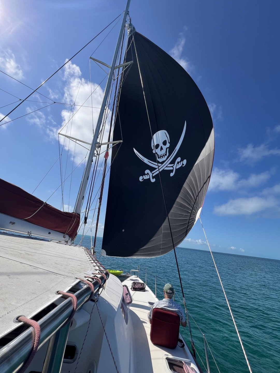
Under sail with the Pirate Spinnaker on our way from Hope Town to Man O War Cay.

I even spent some time knitting in the swinging chair.

Sunset from our anchorage off Man O War Cay, February 1, 2025.
We would spend two nights here.

Sunrise Man O War Cay, February 2, 2025.

We were anchored off an area called the Narrows.
Directly behind the silhouetted vehicle and gazebo is the Atlantic Ocean.

A ship bringing supplies to one of the islands.
After finishing my morning cup of tea on Sunday morning, February 2, Scott taxied me over to the Narrows so I could go for a nice morning walk.

My "taxi" driver heading back to Soarin' Frree.

The Narrows is narrow!
Looking north with the Atlantic on the right, Soarin' Free anchored to the left.
I would walk south on this morning, into the little town.

Heading toward town.

Narrow passage - just big enough for the golf carts that are this island's vehicles.

Coconut palms abound!

Oh no! Wonder what these Red Bats look like?

Yep, Red Bats in a cage.

More of the Queen's Highway.

Wondered what made these tracks.
I eventually found out from a 10 year old girl named Kathryn.

On my way into town I noticed three young girls playing here.
Later I would see them pass me on the back of a golf cart.
And eventually I met one of them named Kathryn.

As far as I could go south on Man O War Cay - about 2 miles from the Narrows.

A house not rebuilt since Hurricane Dorian.

On my way back to the Narrows I noticed this little church shortly before 11:00.
The sign said worship was 11:00 so I joined the local congregation.
The church is where I met Kathryn. I sat in the back pew and when she wandered nearby before the service started I greeted her and we had a nice conversation. She remembered seeing me when she was sitting facing backwards in the golf cart. She said she was born in the U.S., but her family has always lived on Man O War Cay. I asked her favorite thing about living there, and after pondering the question she responded, "The cold water in the summer." When I asked how she spelled her name she responded at first by saying not the way most people do and then she spelled it just like I do. Her smile really lit up when she found out that we spell our name the same way!
After returning to Soarin' Free and lunch Scott, Kristy and I went snorkeling near the Narrows. Here we saw mostly sea stars, some quite large, and sea muffins. Then we all headed to shore and Rob went in the water! It was the warmest day we'd had so he decided it was time to get wet.

A sight not often seen - Rob in the water, but notice, his head is not wet.

But mine is! Swimming Hole 23

Sunrise over Man O War Cay, February 3.

Silhouette on the Narrows.

Monday morning, February 3, I headed north on my walk.
Notice the interesting walled sides of the road.
This was definitely the "high rent" district.

A close up of the wall made of rock, coral and shells.

This was as far as I could go north.
This is the entrance to a private resort of some kind.

Another example of the tracks crossing golf cart tracks.
I asked another walker I met, an adult who has lived in The Bahamas her whole life, what these tracks might be from. She had no idea what they were.

Someone figures this is their end of the Rainbow.
Where would yours be?

A view to the Atlantic.

Heading back south across the Narrows.
I walked back into town again.

An Alligator in a front yard!
Pretty good statue!

Kathryn's house, on the edge of town.
I think this building is actually resort lodging currently under repair from damage done by Hurricane Dorian. On my way into town on Monday I saw Kathryn at the house and we greeted each other. I described the tracks I had seen in the sand and she said it sounded like it might be crab tracks. I looked up crab tracks on Google and sure enough Kathryn was correct.


In town the Queen's Highway is paved.

A sweet little coffee shop - too bad it was closed on Monday.

The entrance to one house along the way, lined with conch shells.

Back at the gazebo waiting for my "taxi" (Scott in the dinghy) to pick me up.
After returning to Soarin' Free we pulled the anchor and headed toward our last anchorage in Marsh Harbor. On the way we stopped at Mermaid Reef for one more swimming hole.
Under the spinnaker on the way to Mermaid Reef

Oh, that water!

Swimming hole #24.

Snorkeling with Scott over Mermaid Reef.
The highlight here was fish that swam almost within reach.
Scott said he touched some, but I never quite managed to touch any.
After anchoring in Marsh Harbor so we'd be ready to go to the airport on Tuesday morning Scott and I went to shore with the dinghy so I could go mail some postcards. International postage to the U.S. from The Bahamas was only 50 cents! We walked to the Government building where the post office was and then to the grocery store to get some ice cream, and back to the boat for one more night with Scott and Kristy.

The government building.
It looked new, but we found out this building had survived the hurricane,
but it did have a new coat of paint!
It served as a shelter for those displaced in 2019 by Hurricane Dorian.

Courtyard inside the building.

Scott poling the dinghy over to the steps where I could easily board.

My last Bahamas sunrise, February 4.

And one last game of hearts before we head to the airport.
Board games were a regular part of each day on board Soarin' Free.

Heading to a land taxi to take us to the airport. Tuesday morning, February 4.

The plane we would board, and that also brought Scott and Kristy's new guests.

AJ, Mike, Liam and Abby arriving from New Hampshire for a high energy week.

Goodbye Marsh Harbor!
If you zoom in on the harbor you can see the red Soarin' Free.

Arriving back to Camp Taylor after quite the storm.
The tent would pop back up, more details in the next post!
Critters in Roseville:

Elsie looking a bit annoyed.

Joy and Ellie relaxing.
Comments
Post a Comment